Badger Mountain (Tri-Cities)
| Badger Mountain | |
|---|---|

Badger Mountain from the Richland Y.
|
|
| Highest point | |
| Elevation | 1,593 ft (486 m) NAVD 88 |
| Prominence | 915 ft (279 m) |
| Isolation | 8.44 mi (13.58 km) |
| Coordinates | 46°14′04″N 119°19′17″W / 46.234344°N 119.321525°WCoordinates: 46°14′04″N 119°19′17″W / 46.234344°N 119.321525°W |
| Geography | |
|
|
|
| Parent range | Columbia River Plateau |
| Topo map | USGS Badger Mountain |
| Climbing | |
| Easiest route | Hike |
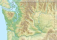
Badger Mountain is a small mountain in Richland, Washington. Badger rises above the Tri-Cities connected to the smaller Candy Mountain via Goose Gap, is visible throughout much of the area and is a popular hiking destination for a wide variety of climbers. There are a number of trails climbing the mountain with varying levels of difficulty. Most of Badger Mountain is protected by the Badger Mountain Centennial Preserve, but the radio towers at the peak are private property. There are two summits on Badger Mountain, named the East Summit and the West Summit. The West Summit is the highest.
Badger Mountain is a member of the Yakima Fold Belt, a series of topographical folds (or wrinkles) raised from tectonic compression. The Yakima Fold Belt extends from Interstate 90 near Vantage, Washington to the Columbia River near Wallula, Washington. The Yakima Fold Belt is a portion of the larger Olympic-Wallowa Lineament, which extends from near Port Angeles, Washington into northeastern Oregon.
Badger Mountain is also a part of the Columbia River Basalt Group. Sometime between 10 and 15 million years ago, multiple lava flows poured out from the Yellowstone hotspot, then located in western Idaho. These lava flows covered large portions of Washington and Oregon on their way to the Pacific Ocean and are the cause of the underlying basalt of the region. In some areas, the basalt was 5,900 feet (1,800 m) thick.
...
Wikipedia

