Bad Marienberg (Westerwald)
| Bad Marienberg | ||
|---|---|---|
|
||
| Coordinates: 50°39′07″N 7°57′08″E / 50.65194°N 7.95222°ECoordinates: 50°39′07″N 7°57′08″E / 50.65194°N 7.95222°E | ||
| Country | Germany | |
| State | Rhineland-Palatinate | |
| District | Westerwaldkreis | |
| Municipal assoc. | Bad Marienberg (Westerwald) | |
| Government | ||
| • Mayor | Sabine Willwacher (SPD) | |
| Area | ||
| • Total | 9.96 km2 (3.85 sq mi) | |
| Elevation | 470 m (1,540 ft) | |
| Population (2015-12-31) | ||
| • Total | 5,895 | |
| • Density | 590/km2 (1,500/sq mi) | |
| Time zone | CET/CEST (UTC+1/+2) | |
| Postal codes | 56470 | |
| Dialling codes | 02661 | |
| Vehicle registration | WW | |
| Website | www.bad-marienberg.de | |
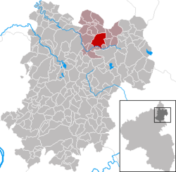
Bad Marienberg (Westerwald) is a town in the Westerwaldkreis in Rhineland-Palatinate, Germany, and also the seat of the like-named Verbandsgemeinde, a kind of collective municipality.
The community lies in the Westerwald between Limburg and Siegen. From east to west through the town flows the river Nister, which is part of the Sieg drainage basin.
Bad Marienberg’s Stadtteile are Eichenstruth, Langenbach and Zinhain.
In 1048, Bad Marienberg had its first documentary mention. It is likely that this same source gave rise to the name Westerwald, since the area around Bad Marienberg lies directly west of Herborn. In 1258, Marienberg was described as Mons sanctae Mariae. In the 18th century, the formerly separate communities of Obermarienberg, still an easily recognizable ring-shaped settlement around the parish church today, and Untermarienberg grew together.
Marienberg was part of the lordly domain in the Westerwald that was formed out of the three Gerichte (official regions) of Marienberg, Emmerichenhain and Neukirch, and which Count Otto I of Nassau won in 1255 in the Ottonian-Walramian hereditary division. After a further division in 1303, the area passed to Otto’s son Henry III of Nassau-Siegen, making it part of Nassau-Dillenburg. From 1343 to 1561, the overlordship in the Westerwald was then held by the Nassau-Dillenburg-Beilstein branch of the family. After they died out, Count Johann VI of Nassau-Dillenburg ("the Elder") received the inheritance, thereby uniting these German lands – albeit only for a short time.
After further territorial exchanges within the Nassau dynasty through inheritances, Marienberg ended up, as part of the Beilstein lordly domain, under Prince William IV’s governance. Once again, in 1742-1743, he succeeded in uniting all Ottonian lands within the Holy Roman Empire. Within the Orange German possessions now ruled from Dillenburg, Marienberg was at the latest by 1783 put under the Amt of Beilstein. The parish of Marienberg counted roughly 450 souls in 1580 and included the villages of Bach, Bölsberg, Eichenstruth, Fehl, Großseifen, Illfurth, Langenbach, Marienberg, Hof, Pfuhl, Ritzhausen, Stockhausen, Unnau and Zinhain. The Counties of Sayn-Hachenburg and Sayn-Altenkirchen both lay only a few kilometres away to the northwest.
...
Wikipedia


