
Siegen
| Siegen | ||
|---|---|---|

Upper town
|
||
|
||

Siegen
|
||
|
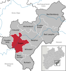
Location of Siegen within Siegen-Wittgenstein district
  |
||
| Coordinates: 50°53′N 8°1′E / 50.883°N 8.017°ECoordinates: 50°53′N 8°1′E / 50.883°N 8.017°E | ||
| Country | Germany | |
| State | North Rhine-Westphalia | |
| Admin. region | Arnsberg | |
| District | Siegen-Wittgenstein | |
| Government | ||
| • Mayor | Steffen Mues (CDU) | |
| Area | ||
| • Total | 114.67 km2 (44.27 sq mi) | |
| Population (2015-12-31) | ||
| • Total | 102,355 | |
| • Density | 890/km2 (2,300/sq mi) | |
| Time zone | CET/CEST (UTC+1/+2) | |
| Postal codes | 57001–57080 | |
| Dialling codes | 0271 | |
| Vehicle registration | SI | |
| Website | www.siegen.de | |

Siegen (German pronunciation: [ˈziːɡən]) is a city in Germany, in the south Westphalian part of North Rhine-Westphalia.
It is located in the district of Siegen-Wittgenstein in the Arnsberg region. The university town (18.600 students in the 2013–2014 winter semester) is the district seat, and is ranked as a "higher centre" in the South Westphalian urban agglomeration.
In 1975, in the process of municipal reforms and amalgamations, Siegen's population exceeded the 100,000 mark.
The city of Siegen lies in the basin of the upper reaches of the river Sieg. From there, lateral valleys branch off in many directions. The heights of the surrounding mountains, wherever they are not actually settled, are covered in coppice. To the north lies the Sauerland, to the northwest the Rothaargebirge and to the southwest the Westerwald.
The nearest cities to Siegen, taking into account average travelling distances, are Hagen to the north (83 km), Frankfurt am Main to the southeast (125 km), Koblenz to the southwest (105 km) and Cologne to the west (93 km).
As the crow flies the distances to these places are, however, 65 km (40 mi) (Hagen), 95 km (59 mi) (Frankfurt), 65 km (40 mi) (Koblenz) and 75 km (47 mi) (Cologne).
The city lies on the German-Dutch holiday road called the Orange Route, joining towns, cities and regions associated with the House of Orange.
The city's total land area is roughly 115 km2 (44 sq mi). Its greatest east-west span is about 12 km (7 mi), and its greatest north-south span is about 12 km (7 mi). City limits are 48 km (30 mi) long. Siegen lies at a median elevation of 290 m (951 ft) above sea level. The city's greatest elevation is the peak of the Pfannenberg at 499 m (1,637 ft) above sea level at southern city limits. Siegen's lowest point is 215 m (705 ft) above sea level at Niederschelden at southwestern city limits, which there also forms the state boundary with Rhineland-Palatinate. Roughly 60% of the city's land is wooded, making Siegen one of Germany's greenest cities.
...
Wikipedia