Bécancour, Quebec
| Bécancour | ||
|---|---|---|
| City | ||

Sainte-Angèle-de-Laval
|
||
|
||
| Motto: Vivre et grandir ("To live and to grow") |
||
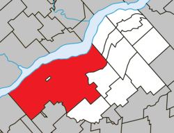
 Location within Bécancour RCM. |
||
| Location in southern Quebec. | ||
| Coordinates: 46°20′N 72°26′W / 46.333°N 72.433°WCoordinates: 46°20′N 72°26′W / 46.333°N 72.433°W | ||
| Country |
|
|
| Province |
|
|
| Region | Centre-du-Québec | |
| RCM | Bécancour | |
| Constituted | October 17, 1965 | |
| Government | ||
| • Mayor | Jean-Guy Dubois | |
| • Federal riding | Bécancour—Nicolet—Saurel | |
| • Prov. riding | Nicolet-Bécancour | |
| Area | ||
| • Total | 494.60 km2 (190.97 sq mi) | |
| • Land | 440.74 km2 (170.17 sq mi) | |
| Elevation | 148 m (486 ft) | |
| Population (2011) | ||
| • Total | 12,438 | |
| • Density | 28.2/km2 (73/sq mi) | |
| • Pop 2006-2011 |
|
|
| • Dwellings | 5,667 | |
| Time zone | EST (UTC−5) | |
| • Summer (DST) | EDT (UTC−4) | |
| Postal code(s) | G9H | |
| Area code(s) | 819 | |
| Highways |
|
|
| Website | www |
|
Bécancour (French pronunciation: [bekɑ̃kuʁ]) is a city in the Centre-du-Québec region of Québec, Canada; it is the seat of the Bécancour Regional County Municipality. It is located on the south shore of the Saint Lawrence River at the confluence of the Bécancour River, opposite Trois-Rivières.
Wôlinak, an Abenaki Indian reserve, is an enclave within the town of Bécancour. They arrived from Norridgewock, Maine (formerly Acadia) in the aftermath of Father Rale's War.
There was a small migration of Acadians to the village (1759), after the British began the Expulsion of the Acadians from the Maritimes. Specifically, the Acadians migrated from present-day New Brunswick to avoid being killed or captured in the St. John River Campaign.
The town of Bécancour was created October 17, 1965, from an amalgamation of eleven municipalities. Bécancour was one of the province of Quebec's first amalgamated cities. At the time, Bécancour was the largest city in Quebec in terms of land area (as of 2003, the title belongs to La Tuque, Quebec).
...
Wikipedia


