Avondale, Arizona
| Avondale, Arizona | |
|---|---|
| City | |

Entrance to the town of Avondale
|
|
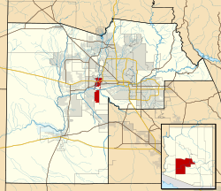
 Location in Maricopa County and the state of Arizona Phoenix |
|
| Location in the United States | |
| Coordinates: 33°26′01″N 112°20′59″W / 33.43361°N 112.34972°WCoordinates: 33°26′01″N 112°20′59″W / 33.43361°N 112.34972°W | |
| Country | United States |
| State | Arizona |
| County | Maricopa |
| Government | |
| • Mayor | Kenn Weise |
| Area | |
| • Total | 45.1 sq mi (116.81 km2) |
| • Land | 45 sq mi (116.55 km2) |
| • Water | 0.1 sq mi (0.2 km2) |
| Elevation | 974 ft (297 m) |
| Population (2010) | |
| • Total | 76,238 |
| • Estimate (2014) | 79,646 |
| • Density | 1,735.17/sq mi (669.94/km2) |
| Time zone | MST (no daylight saving time) (UTC-7) |
| ZIP code | 85323, 85392 |
| Area code(s) | 623 |
| FIPS code | 04-04720 |
| Website | http://www.ci.avondale.az.us/ |
Avondale is a city in Maricopa County, Arizona, United States, adjacent to Phoenix, Arizona. According to the 2010 census, the population of the city is 76,238.
Avondale, incorporated in 1946, experienced rapid residential and commercial growth in the years since 1980. Once primarily a sparsely populated farming community with many acres of alfalfa and cotton fields, Avondale has transformed into a major bedroom suburb for Phoenix. Several major residential subdivisions and shopping centers have recently been built on former farmland, many adjacent to Interstate 10.
Phoenix Children's Hospital opened a satellite facility (the Southwest Valley Urgent Care Center), at the corner of Avondale Boulevard and McDowell Road in the spring of 2013. Avondale's main arterial streets leading into the city of Phoenix, including Van Buren Street and McDowell Road, have been widened and modernized to a more "suburban" and less "rural" appearance and function.
Avondale is located at 33°26′01″N 112°20′59″W / 33.43361°N 112.34972°W (33.435322, -112.349758).
According to the United States Census Bureau, the city has a total area of 41.3 square miles (107 km2), of which, 41.3 square miles (107 km2) of it is land and 0.1 square miles (0.26 km2) of it (0.15%) is water.
As of the census of 2000, there were 35,883 people, 10,640 households, and 8,724 families residing in the city. The population density was 869.7 people per square mile (335.8/km²). There were 11,419 housing units at an average density of 276.8 per square mile (106.9/km²). The racial makeup of the city was 63.27% White, 5.20% Black or African American, 1.28% Native American, 1.89% Asian, 0.14% Pacific Islander, 24.32% from other races, and 3.89% from two or more races. 46.23% of the population were Hispanic or Latino of any race.
...
Wikipedia

