Au Sable River (Michigan)
| Au Sable River | |
|---|---|

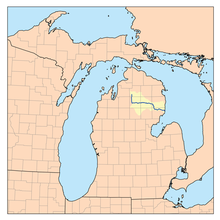
Map of the Au Sable River
|
|
| Country | United States |
| Basin features | |
| Main source | Frederic Township, Crawford County, Michigan |
| River mouth |
Lake Huron at Au Sable, Michigan 581 ft (177 m) |
| Physical characteristics | |
| Length | 138 miles (222 km) |
The Au Sable River in Michigan, United States runs approximately 138 miles (222 km) through the northern Lower Peninsula, through the towns of Grayling and Mio, and enters Lake Huron at Oscoda. It is considered one of the best brown trout fisheries east of the Rockies and has been designated a blue ribbon trout stream by the Michigan Department of Natural Resources. In French, au sable literally means "at the sand." A 1795 map calls it the Beauais River.
The Au Sable has a drainage basin of 1,932 square miles (5,000 km2) and an average flow of 1,100 ft3/s (31 m3/s) at its mouth. The river drops 650 feet (200 m) from its source at the junction of Kolka and Bradford Creeks.
The main stream of the river is formed at 44°48′21″N 84°45′29″W / 44.80583°N 84.75806°W in Frederic Township in Crawford County by the confluence of Kolke and Bradford Creeks, which both rise in Otsego County. The river flows south then turns east through Grayling, where it is joined by the East Branch Au Sable River at 44°39′55″N 84°42′13″W / 44.66528°N 84.70361°W. The East Branch rises in Lovells Township, Crawford County at 44°49′46″N 84°35′59″W / 44.82944°N 84.59972°W.
...
Wikipedia
