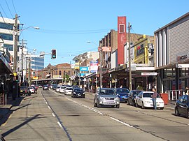
Ashfield, New South Wales
|
Ashfield Sydney, New South Wales |
|||||||||||||
|---|---|---|---|---|---|---|---|---|---|---|---|---|---|

Liverpool Road, Ashfield
|
|||||||||||||
| Population | 22,189 (2011 census) | ||||||||||||
| • Density | 6,340/km2 (16,420/sq mi) | ||||||||||||
| Established | 1838 | ||||||||||||
| Postcode(s) | 2131 | ||||||||||||
| Area | 3.5 km2 (1.4 sq mi) | ||||||||||||
| Location | 9 km (6 mi) west of Sydney CBD | ||||||||||||
| LGA(s) | Inner West Council | ||||||||||||
| State electorate(s) | |||||||||||||
| Federal Division(s) | |||||||||||||
|
|||||||||||||
Ashfield is a suburb in the Inner West of Sydney, in the state of New South Wales, Australia. Ashfield is about 9 kilometres south-west of the Sydney central business district.
Ashfield's population is highly multicultural. Its urban density is relatively high for Australia, with the majority of the area's dwellings being a mixture of mainly post-war low-rise flats (apartment blocks) and Federation-era detached houses. Amongst these are a number of grand Victorian buildings that offer a hint of Ashfield's rich cultural heritage.
Prior to the arrival of Europeans, the area now known as Ashfield within a broader area Wangal people moved and lived, having migrated from South East Asia and then downwards. Exact numbers are unknown, some research indicates there was between 8000 and 10000 aboriginal people in the broader Sydney region, fluctuating with the seasons and tribal conflict. Their territory was believed to be centred on modern-day Concord and stretched east to the swampland of Long Cove Creek (now known as Hawthorne Canal). The land was heavily wooded at the time with tall eucalypts covering the higher ground and a variety of swampy trees along Iron Cove Creek. The people hunted by killing native animals and fish. Violence is known to have occurred both between tribes and within tribes, in particular towards women.
By 1790, a rough track had been built between the colony's two settlements at Sydney Cove and Parramatta. This route later became the main artery of the expanding Greater Sydney and, as the northern boundary of what is now Ashfield, dictated early British settlement in the area. The first land grant in the area was made to Rev Richard Johnson in 1793 and all of it had been granted by 1810. By the 1820s, all the grants had been amalgamated into two large estates: Ashfield Park (the northern half between Liverpool Rd and Parramatta Rd) and Canterbury Estate (the area south of Liverpool Rd). Ashfield Park was named by Robert Campbell, whose father was the laird of Ashfield in Scotland.
...
Wikipedia
