Arvada, Wyoming
| Arvada, Wyoming | |
|---|---|
| CDP | |
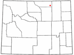
 Location of Arvada, Wyoming |
|
| Location in the United States | |
| Coordinates: 44°39′15″N 106°7′52″W / 44.65417°N 106.13111°WCoordinates: 44°39′15″N 106°7′52″W / 44.65417°N 106.13111°W | |
| Country | United States |
| State | Wyoming |
| County | Sheridan |
| Area | |
| • Total | 1.75 sq mi (4.5 km2) |
| • Land | 1.75 sq mi (4.5 km2) |
| • Water | 0.0 sq mi (0 km2) |
| Elevation | 3,671 ft (1,119 m) |
| Population (2010) | |
| • Total | 43 |
| • Density | 25/sq mi (9.5/km2) |
| Time zone | Mountain (MST) (UTC-7) |
| • Summer (DST) | MDT (UTC-6) |
| ZIP code | 82831 |
| Area code(s) | 307 |
| FIPS code | 56-03725 |
| GNIS feature ID | 1609064 |
Arvada is a census-designated place (CDP) in Sheridan County, Wyoming, United States. The population was 43 at the 2010 census.
Arvada is located at 44°39′15″N 106°7′52″W / 44.65417°N 106.13111°W (44.654207, −106.131238).
According to the United States Census Bureau, the CDP has a total area of 1.75 square miles (4.5 square kilometres), all of it land.
According to the Köppen Climate Classification system, Arvada has a semi-arid climate, abbreviated "BSk" on climate maps.
Arvada, Wyoming is located on the west bank of the Powder River, about fifty miles northwest of Gillette. From 1888 to 1891, a stage line that ran from Sundance to Buffalo crossed the Powder River on a ferry boat at the future site of Arvada. The town of Suggs, Wyoming was established on the east bank of the river in 1891, and a post office opened September 14, 1891. Suggs was named for a local rancher.
During the summer of 1892, railroad crews working on the Burlington and Missouri River Railroad, built a bridge across the Powder River at Suggs, although the railroad had only reached Gillette at that point in time. Suggs quickly became an "end of tracks town" with bars, brothels, and gambling establishments.
...
Wikipedia

