Gillette, Wyoming
| Gillette, Wyoming | |
|---|---|
| City | |

Gillette seen from I-90
|
|
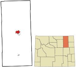
 Location in Campbell County, Wyoming and the state of Wyoming. |
|
| Coordinates: 44°16′58″N 105°30′19″W / 44.28278°N 105.50528°WCoordinates: 44°16′58″N 105°30′19″W / 44.28278°N 105.50528°W | |
| Country | United States |
| State | Wyoming |
| County | Campbell |
| Government | |
| • Mayor | Louise Carter-King |
| Area | |
| • Total | 19.00 sq mi (49.21 km2) |
| • Land | 18.97 sq mi (49.13 km2) |
| • Water | 0.03 sq mi (0.08 km2) |
| Elevation | 4,554 ft (1,388 m) |
| Population (2010) | |
| • Total | 29,087 |
| • Estimate (2014) | 31,971 |
| • Density | 1,533.3/sq mi (592.0/km2) |
| Time zone | Mountain (MST) (UTC-7) |
| • Summer (DST) | MDT (UTC-6) |
| ZIP code | 82716-82718 |
| Area code(s) | 307 |
| FIPS code | 56-31855 |
| GNIS feature ID | 1609094 |
| Website | gillettewy.gov |
Gillette is a city in and the county seat of Campbell County, Wyoming, United States. The population was estimated at 31,797 as of 1 July 2013. Gillette is centrally located in an area involved with the development of vast quantities of American coal, oil, and coalbed methane gas. The city calls itself the "Energy Capital of the Nation," noting that the state of Wyoming provides nearly 35% of the nation's coal. Over the last decade Gillette saw a population increase of 48% from the 2000 census of 19,646 residents.
Gillette was incorporated on January 6, 1892, less than two years after Wyoming became a state. The city was named after Edward Gillette, who worked as a surveyor for the Chicago, Burlington and Quincy Railroad. Companies based in Gillette include Cloud Peak Energy.
In 1974, U.S. psychologist ElDean Kohrs used the town as the basic example of what he called the 'Gillette Syndrome': the social disruption that can occur in a community due to rapid population growth. During the 1960s, Gillette doubled its population from 3,580 to 7,194 residents. Kohrs proposed that this fast increase of population caused the phenomenon known as Gillette Syndrome, resulting in increased crime, high costs of living and weakened social and community bonds.
Gillette is located at 44°16′58″N 105°30′19″W / 44.28278°N 105.50528°W (44.282660, −105.505256). It is situated between the Big Horn Mountains to the west and the Black Hills to the east, in the Powder River Basin.
...
Wikipedia
