Ardsley, New York
| Ardsley, New York | |
|---|---|
| Village | |

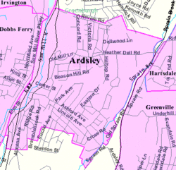
Map of Ardsley, New York
|
|
 Location of Ardsley, New York |
|
| Coordinates: 41°0′41″N 73°50′29″W / 41.01139°N 73.84139°WCoordinates: 41°0′41″N 73°50′29″W / 41.01139°N 73.84139°W | |
| Country | United States |
| State | New York |
| County | Westchester |
| Town | Greenburgh |
| Area | |
| • Total | 1.3 sq mi (3.4 km2) |
| • Land | 1.3 sq mi (3.4 km2) |
| • Water | 0.0 sq mi (0.0 km2) |
| Elevation | 210 ft (64 m) |
| Population (2010) | |
| • Total | 4,452 |
| • Density | 3,400/sq mi (1,300/km2) |
| Time zone | Eastern (EST) (UTC-5) |
| • Summer (DST) | EDT (UTC-4) |
| ZIP code | 10502 |
| Area code(s) | 914 |
| FIPS code | 36-02506 |
| GNIS feature ID | 0942544 |
Ardsley is a village in Westchester County, New York, United States. It is part of the town of Greenburgh. The village's population was 4,452 at the 2010 census. The current mayor of Ardsley is Peter Porcino.
The Ardsley post office serves the entire village of Ardsley plus some nearby unincorporated sections of Greenburgh. The Ardsley Union Free School District includes the entire village of Ardsley plus parts of the village of Dobbs Ferry and unincorporated parts of Greenburgh. Ardsley has a library that is a member of the Westchester Library System.
Ardsley should not be confused with the nearby hamlet of Ardsley-on-Hudson, which is part of the village of Irvington.
Before the area where Ardsley is now located was settled by Europeans, it was inhabited by the Wickquasgeck Indians, a band of the Wappingers, related to the Lenape (Delaware) tribes which dominated lower New York state and New Jersey.
After the Dutch came to the area, the land was part of the Bisightick tract of the Van der Donck grant purchased by Frederick Philipse in 1682, but in 1785 the state of New York confiscated the land from his grandson, Frederick Philipse III, after he sided with the British in the American Revolution, and sold it to local patriot farmers who had been tenants of the Phillipse family.
The village of Ashford was formed from some of these portions, named for the main road. Notable businesses included a blacksmith, and a sawmill and grist mill both situated upon the Saw Mill River. Three pickle factories were in operation by the Civil War, and in the 1880s the construction of the Putnam Railroad and New Croton Aqueduct led to a population boom which saw the installation of electric lighting and improved roads. Due to the presence of an earlier Ashford Post Office in New York state, the town took the name "Ardsley" after the name of a local baron's estate, and the first village postmaster was appointed in 1883.
...
Wikipedia
