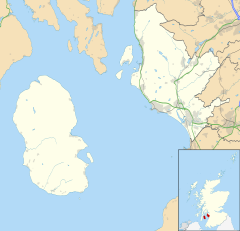
Ardeer, Scotland
| Ardeer | |
|---|---|
| Ardeer shown within North Ayrshire | |
| Population |
9,129 (2001 census) |
| OS grid reference | NS282406 |
| Council area | |
| Lieutenancy area | |
| Country | Scotland |
| Sovereign state | United Kingdom |
| Post town | STEVENSTON |
| Postcode district | KA20 |
| Dialling code | 01294 |
| Police | Scottish |
| Fire | Scottish |
| Ambulance | Scottish |
| EU Parliament | Scotland |
| UK Parliament | |
| Scottish Parliament | |
9,129 (2001 census)
Ardeer was a small town now officially incorporated into Stevenston on the Ardeer peninsula, in the parish of Stevenston, North Ayrshire, originally an island and later its extensive sand dune system became the site of Nobel Explosives, a dominant global supplier of explosives to the mining and quarrying industries and a major player in the design and development of products for the chemical and defence industries during the 20th century.
Ardeer was once an island with a sea channel running along to exit in the vicinity of Auchenharvie Academy. Blaeu's map of 1654, based on Timothy Ponts map of circa 1600 clearly shows a small island with the settlements of Ardeer, Dubbs, Bogend, Longford, Snodgrass, Lugton Mill and Bartonholm all being on or near the coastline. The island was small and extended no further than Bartonholm, nowhere near the size of the present day Ardeer peninsula. The Lugton Water opened into the bay at that time and not into the Garnock. Robert Gordon's map of 1636-52 highlights the coastline as being much further inland than at present and the island of Ardeer is not shown, cross-hatching or crossing out being shown. Roy. It was at around this time that the old harbour at Seagatefoot was finally abandoned a new harbour built at Fullarton in 1665 and the extreme sand movements recorded in relation to the old harbour may have also choked the sea channel that had made Ardeer an island.
A map of 1872 shows a sizeable island at the tip of the Ardeer peninsula that included the site of the present day Big Idea complex. This island is not recorded on the later Ordnance Survey maps and was therefore of a transient nature due to the shifting sands, storm derived blow outs, etc. typical of large sand dune and estuary systems.
As late as 1902 it was recorded that "Within recent years a number of little lochs, or dubbs, existed between Kilwinning and Stevenston, the memory of which, at least, has been preserved in the name of Dubbs Farm." Ardeer House, Castlehill, Bartonholm, and Bogside were on the coast. The geology of the area shows river deposits along the course of the old river bed.
By the late 17th century the island had become a peninsula, for John Adair's map of 1685 does not show an island and the River Garnock follows its current course. Armstrong's map of 1747–55 also does not show an island and the area is marked as being only sand dunes, the first habitation being at Knowes and Bog. A road, the Knowes Road, followed the route of the old water course, running from Stevenston to Kilwinning.
...
Wikipedia

