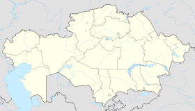
Aral, Kazakhstan
|
Aral Арал |
||
|---|---|---|
 |
||
|
||
| Location in Kazakhstan | ||
| Coordinates: 46°47′0″N 61°40′0″E / 46.78333°N 61.66667°E | ||
| Country |
|
|
| Region | Kyzylorda | |
| Population (2009) | ||
| • Total | 29,987 | |
Aral, also known as Aralsk or Aral'sk, (Kazakh: Арал, Aral, ارال; Russian: Аральск, Araljsk) Coordinates: 46°47′N 61°40′E / 46.783°N 61.667°E is a small city in south-western Kazakhstan, located in the oblast (region) of Kyzylorda. It serves as the administrative center of Aral District. Aral was formerly a fishing port and harbour city on the banks of the Aral Sea, and was a major supplier of fish to the neighboring region. Population: 29,987 (2009 Census results); 30,347 (1999 Census results).
In 1817, there was a village Alty-Kuduk (Six Wells) near the present city of Aralsk. This is currently a railway passing-track in the southern part of the city. Since the 1870s, this was recorded as the Aralsky settlement. The development of Aralsk began when the Orenburg-Tashkent railway was being constructed (1899-1905). In 1905, the railway station was constructed and continues to operate. The official history of Aralsk began that same year.
In 1905, Russian merchants organized large fishing companies and formed a joint-stock firm in Aralsk. This was the beginning of fishery in the Aral Sea and ship-building plants soon followed in Aralsk.
After the Revolution, the station “Aralskoye more (sea)” with the adjoining settlement received the name Aralsk. In 1938, Aralsk and the Aralsky district became a part of newly formed Kzyl-Orda oblast of Kazakh SSR and turned into the town.
Aralsk is not to be confused with Fort Aralsk which was about 120km south. In 1847 Russia built Raimsk, later called Fort Aralsk, near the mouth of the Syr Darya. In either 1848 or 1853 or 1855 Raimsk was abandoned and Fort Aralsk moved upriver to Fort Number One, or Kazalinsk. Further upriver were forts No. 2 and 3 which were the old Kokandi forts of Karmaktschy and Kumish-Kurgan. Fort Aralsk was used to launch ships to map the Aral Sea and as a base to attack Ak Mechet.
...
Wikipedia


