Appomattox County, VA
| Appomattox County, Virginia | ||
|---|---|---|

The Appomattox County Courthouse in October 2007
|
||
|
||
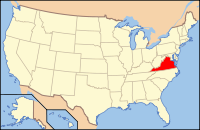
 Location in the U.S. state of Virginia |
||
 Virginia's location in the U.S. |
||
| Founded | 1845 | |
| Named for | Appomattox River | |
| Seat | Appomattox | |
| Largest town | Appomattox | |
| Area | ||
| • Total | 335 sq mi (868 km2) | |
| • Land | 333 sq mi (862 km2) | |
| • Water | 1.2 sq mi (3 km2), 0.4% | |
| Population (est.) | ||
| • (2015) | 15,414 | |
| • Density | 46/sq mi (18/km²) | |
| Congressional district | 5th | |
| Time zone | Eastern: UTC-5/-4 | |
| Website | www |
|
Appomattox County is a United States county located in the Piedmont region and near the center of the Commonwealth of Virginia. The county is part of the Lynchburg, VA Metropolitan Statistical Area, and its county seat is the town of Appomattox.
Appomattox County was created in 1845 from sections of four other Virginia counties. The name of the county comes from the Appomattox River, which rises in the county, while the river was named for the Appamatuck Indians. The county is historically associated with the surrender of Robert E. Lee at Appomattox Court House, which effectively ended the American Civil War.
As of the 2010 census, the population was 14,973. This was an increase of more than 9 percent from the 13,705 reported in the 2000 census.
Appomattox County was formed in 1845 from Buckingham, Prince Edward, Campbell and Charlotte counties. In 1848, another part from Campbell County was added. It was named for the Appomattox River, which in turn was named for the Appamatuck, a historic Native American tribes in Virginia of the Algonquian-speaking Powhatan Confederacy.
...
Wikipedia

