Aoba Island
| Aoba Ambae |
|
|---|---|
| Island | |

Aoba (Ambae) Island, image acquired by the Space Shuttle Endeavour
|
|
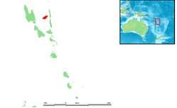
 Location within Vanuatu |
|
| Coordinates: 15°24′0″S 167°50′0″E / 15.40000°S 167.83333°ECoordinates: 15°24′0″S 167°50′0″E / 15.40000°S 167.83333°E | |
| Country |
|
| Province | Penama Province |
| Area | |
| • Total | 398 km2 (154 sq mi) |
| Highest elevation | 1,496 m (4,908 ft) |
| Population (2009) | |
| • Total | 10,407 |
| • Density | 26/km2 (68/sq mi) |
| Time zone | VUT (UTC+11) |
| Aobahi | |
|---|---|
| Highest point | |
| Elevation | 1,496 m (4,908 ft) |
| Prominence | 1,496 m (4,908 ft) |
| Geography | |
| Location | Vanuatu |
| Topo map | 154 square miles |
| Geology | |
| Mountain type | Shield volcano |
| Last eruption | June to July 2011 |
Aoba, also known as Ambae or Leper's Island, is an island in the South Pacific island nation of Vanuatu, located near 15°30′S 167°30′E / 15.500°S 167.500°E.
First recorded sighting by Europeans was by the Spanish expedition of Pedro Fernández de Quirós in the spring of 1606.
The misty sight of Ambae from neighbouring Espiritu Santo, which served as a major World War 2 airbase, inspired the mythical Bali Ha'i in James Michener's Tales of the South Pacific.
Rough, black basalt stones compose its shoreline and surface in many places, though the soils (where present) are rich. The island appears to be covered in nearly unbroken vegetation; inhabited areas feature large gardens and managed forests above, with coconut and cacao plantations usually closer to shore. There are no reliable sources of surface water (rivers, streams, or lakes), save the crater lakes which are inaccessible. Water for all human uses comes from cement-lined wells or water tanks filled with rainwater.
Ambae is physically characterized by the large volcano at its center, Lombenben; indeed, the island is little more than the peak of a volcanic mountain rising dramatically from the sea. This volcano has no visible vents at its apex, only crater lakes. It is, nevertheless, active: a steam and ash eruption began on November 27, 2005, leading to a Level 2 volcano alert and preparations for evacuations. On December 8, the eruption became stronger, displacing around half of the island's roughly 10,000 inhabitants and requiring the evacuation of two hospitals.
...
Wikipedia
