Antipodes Island

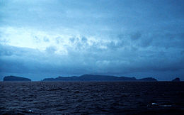
The Antipodes Islands seen from the north
|
|

Position relative to New Zealand and other outlying islands
|
|
| Geography | |
|---|---|
| Location | 860 kilometres (534 mi) southeast of Stewart Island/Rakiura |
| Coordinates | 49°40′0.12″S 178°46′0″E / 49.6667000°S 178.76667°E |
| Archipelago | Antipodes Islands |
| Major islands | Antipodes Island, Bollons Island |
| Area | 22 km2 (8.5 sq mi) |
| Highest elevation | 366 m (1,201 ft) |
| Highest point | Mount Galloway |
| Administration | |
|
New Zealand
|
|
| Demographics | |
| Population | 0 (2006) |
| Additional information | |
| Nature reserve | |
The Antipodes Islands (from Greek αντίποδες - antipodes) are inhospitable volcanic islands in subantarctic waters to the south of — and territorially part of — New Zealand. They lie 860 kilometres (534 mi) to the southeast of Stewart Island/Rakiura.
The island group consists of one main island, Antipodes Island, of 20 km2 (7.7 sq mi) area, Bollons Island to the north, and numerous small islets and stacks.
Ecologically, the islands are part of the Antipodes Subantarctic Islands tundra ecoregion. The islands are inscribed on the UNESCO World Heritage List, together with other subantarctic New Zealand islands. The island group is a nature reserve and there is no general public access.
The word antipodes derives from the Greek: ἀντίποδες, plural of antipous (ἀντίπους) "with feet opposite (ours)", from anti- "opposed" and "foot".
The island group was originally called the "Penantipodes" meaning "next to the antipodes", because it lies near to the antipodes of London. Over time the name has been shortened to "Antipodes" leaving some to suppose its European discoverers had not realised its global location. This misapprehension persists. In fact, the island's antipodes are situated on the territory of the French village Gatteville-le-Phare, near Cherbourg.
The volcanic Antipodes Islands lie 860 kilometres (530 miles) southeast of Stewart Island/Rakiura. They consist of a main island (Antipodes Island), area 20 km2 (7.7 sq mi), surrounded by a series of small offshore islands and rocks. These islands include Bollons Island, at 2 km2 (0.77 sq mi) the second largest in the group, 1,200 m (3,900 ft) to the northeast of the main island's North Cape, and the nearby smaller Archway Island; Leeward Island, situated just off the centre of the main island's east coast (to which it is connected by a rocky bar at low tide); the two Windward Islands, situated 800 m (2,600 ft) apart, the easternmost of which is 600 m (2,000 ft) to the immediate north of Cave Point, the main island's westernmost point; and the tiny Orde Lees Islet, located close to the main island's northwestern shore. Numerous small islets and stacks further surround the coast of the main island.
...
Wikipedia
