Annoisin-Chatelans
| Annoisin-Chatelans | |
|---|---|
| Commune | |

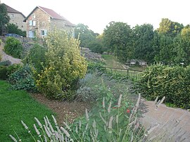
The heights of Chatelans
|
|
| Coordinates: 45°45′28″N 5°17′39″E / 45.7578°N 5.2942°ECoordinates: 45°45′28″N 5°17′39″E / 45.7578°N 5.2942°E | |
| Country | France |
| Region | Auvergne-Rhône-Alpes |
| Department | Isère |
| Arrondissement | La Tour-du-Pin |
| Canton | Charvieu-Chavagneux |
| Intercommunality | L'Isle-Crémieu |
| Government | |
| • Mayor (2014–2020) | Nora Chebbi |
| Area1 | 13.27 km2 (5.12 sq mi) |
| Population (2009)2 | 623 |
| • Density | 47/km2 (120/sq mi) |
| Time zone | CET (UTC+1) |
| • Summer (DST) | CEST (UTC+2) |
| INSEE/Postal code | 38010 /38460 |
| Elevation | 280–452 m (919–1,483 ft) |
|
1 French Land Register data, which excludes lakes, ponds, glaciers > 1 km² (0.386 sq mi or 247 acres) and river estuaries. 2Population without double counting: residents of multiple communes (e.g., students and military personnel) only counted once. |
|
1 French Land Register data, which excludes lakes, ponds, glaciers > 1 km² (0.386 sq mi or 247 acres) and river estuaries.
Annoisin-Chatelans is a commune in the Isère department in the Auvergne-Rhône-Alpes region of southeastern France.
The inhabitants of the commune are known as Nuisantins or Nuisantines
The Village of Annoisin-chatelans is located on the foothills and the plateau of the Isle-Crémieu, some 40 km east of Lyon and just 2 km north-east of the town of Crémieu.
It is part of the Community of communes of l'Isle-Crémieu which includes all the communes around Crémieu, the plain side of Lyon with Chamagnieu and Villemoirieu next to the Optevoz hills area.
The commune is characterized by scattered settlements which comes from the merger of two towns of comparable size, Annoisin which faces Crémieu and Chatelans another two kilometres north which faces on to the valley of Amby (Hières-sur-Amby and Optevoz). There are also two other hamlets south of the village called Michalieu and Le Mollard.
Access to the commune is by the D521 minor road from Crémieu in the south passing though the heart of the commune and the village and continuing north then east to join the D52A to Optevoz. The commune is quite heavily forested in the north and along the eastern and western borders however the southern part of the commune is farmland.
The plateau of Larina has been occupied since the beginning of the first millennium. There are still traces on the Larina site north of the commune (an oppidum then a Merovingian camp). The first known text on Annoisin was regarding the Parish and its Church in the 1172-1275 period of the Capetian Kings. Formerly attached to Optevoz, Chatelans was attached to the commune of Annoisin in the early twentieth century.
List of Successive Mayors
...
Wikipedia


