Anderson County, South Carolina
| Anderson County, South Carolina | |
|---|---|

Anderson County Courthouse
|
|
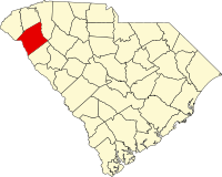
 Location in the U.S. state of South Carolina |
|
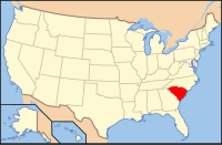
 South Carolina's location in the U.S. |
|
| Founded | December 20, 1826 |
| Named for | Robert Anderson |
| Seat | Anderson |
| Largest city | Anderson |
| Area | |
| • Total | 757 sq mi (1,961 km2) |
| • Land | 715 sq mi (1,852 km2) |
| • Water | 42 sq mi (109 km2), 5.5% |
| Population (est.) | |
| • (2015) | 194,692 |
| • Density | 262/sq mi (101/km²) |
| Congressional district | 3rd |
| Time zone | Eastern: UTC-5/-4 |
| Website | www |
Anderson County is a county located in the U.S. state of South Carolina. As of the 2010 census, its population was 187,126. Its county seat is Anderson. Named for Revolutionary War leader Robert Anderson, the county is located in northwestern South Carolina, along the Georgia border.
Anderson County is included in the Greenville-Anderson-Mauldin, SC Metropolitan Statistical Area.
Anderson County contains 55,950-acre (226 km2) Lake Hartwell, a U.S. Army Corps of Engineers lake with nearly 1,000 miles (2,000 km) of shoreline for residential and recreational use. The area is a growing industrial, commercial and tourist center. It is the home of Anderson University, a private, selective comprehensive university of approximately 3,000 undergraduate and graduate students.
According to the U.S. Census Bureau, the county has a total area of 757 square miles (1,960 km2), of which 715 square miles (1,850 km2) is land and 42 square miles (110 km2) (5.5%) is water. Anderson County is in the Savannah River basin and the Saluda River basin.
As of the 2010 United States Census, there were 187,126 people, 73,829 households, and 51,922 families residing in the county. The population density was 261.6 inhabitants per square mile (101.0/km2). There were 84,774 housing units at an average density of 118.5 per square mile (45.8/km2). The racial makeup of the county was 80.1% white, 16.0% black or African American, 0.8% Asian, 0.3% American Indian, 1.3% from other races, and 1.5% from two or more races. Those of Hispanic or Latino origin made up 2.9% of the population. In terms of ancestry, 15.9% were American, 13.6% were Irish, 10.8% were English, and 10.2% were German.
...
Wikipedia
