Amsterdam Island
|
Amsterdam Island (New Amsterdam) Île Amsterdam
|
|
|---|---|

Flag
|
|
|
Motto: "Liberté, égalité, fraternité"
|
|
|
Anthem: La Marseillaise
|
|

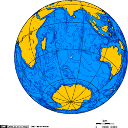
Orthographic projection centred over Île Amsterdam.
|
| Nickname: Nouvelle Amsterdam | |
|---|---|

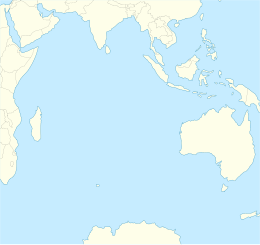
Map of Île Amsterdam.
|
|
| Geography | |
| Coordinates | 37°49′33″S 77°33′17″E / 37.82583°S 77.55472°E |
| Area | 55 km2 (21 sq mi) |
| Length | 10 km (6 mi) |
| Width | 7 km (4.3 mi) |
| Highest elevation | 867 m (2,844 ft) |
| Highest point | Mont de la Dives |
| Administration | |
| Demographics | |
| Population | 25 |
Île Amsterdam (French pronunciation: [ilamstɛʁˈdam], also known as Amsterdam Island, New Amsterdam, or Nouvelle Amsterdam, is an island named after the ship Nieuw Amsterdam, in turn named after the Dutch settlement of New Amsterdam that later became New York City in the United States. It lies in the southern Indian Ocean. It is part of the French Southern and Antarctic Lands and, together with neighbouring Île Saint-Paul 85 km (53 mi) to the south, forms one of the five districts of the territory. The Martin-de-Viviès research station, first called Camp Heurtin and then La Roche Godon, is the only settlement on the island and is home to about thirty non-permanent inhabitants involved in biological, meteorological and geomagnetic studies.
The island was discovered by the Basque Spanish explorer Juan Sebastián Elcano on 18 March 1522, in the course of his voyage of global circumnavigation. However, he did not name the island. Having found the island unnamed, Dutch captain Anthonie van Diemen named it Nieuw Amsterdam after his ship on 17 June 1633. The first recorded landing was made in December 1696 by Dutchman Willem de Vlamingh.
French Captain Pierre François Péron claims he was marooned from 1792 to 1795 on the island. Peron's Memoires, in which he describes his experiences, were published in a limited edition, which is an expensive collectors' item. There was confusion in the early days between Amsterdam and Saint Paul Islands.
...
Wikipedia

