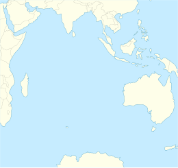
Île Saint-Paul
|
Saint Paul Island Île Saint-Paul
|
|
|---|---|

Flag
|
|
|
Motto: "Liberté, égalité, fraternité"
|
|
|
Anthem: La Marseillaise
|
|

Map of Saint Paul Island.
|

Saint Paul with Quille Rock in the foreground
|
|
| Geography | |
|---|---|
| Coordinates | 38°43′48″S 77°31′20″E / 38.73000°S 77.52222°E |
| Area | 6 km2 (2.3 sq mi) |
| Length | 5 km (3.1 mi) |
| Highest elevation | 268 m (879 ft) |
| Highest point | Crête de la Novara |
| Administration | |
|
France
|
|
| Demographics | |
| Population | Uninhabited |
Île Saint-Paul (Saint Paul Island) is an island forming part of the French Southern and Antarctic Lands (Terres australes et antarctiques françaises, TAAF) in the Indian Ocean, with an area of 6 square kilometres (2.3 sq mi). The island is located about 85 km (53 mi) southwest of the larger Île Amsterdam, and 3,000 km (1,900 mi) southeast of Réunion. It is an important breeding site for seabirds. A scientific research cabin on the island is used for scientific or ecological short campaigns, but there is no permanent population. It is under the authority of a senior administrator on Réunion.
Île Saint-Paul is triangular in shape, and measures no more than 5 km (3.1 mi) at its widest. It is the top of an active volcano, the volcano last erupted in 1793 (from its SW Flank), and is rocky with steep cliffs on the east side. The thin stretch of rock that used to close off the crater collapsed in 1780, admitting the sea through a 100 m (330 ft) channel; the entrance is only a few meters deep, thus allowing only very small ships or boats to enter the crater. The interior basin, 1 km (0.62 mi) wide and 50 m (160 ft) deep, is surrounded by steep walls up to 270 m (890 ft) high. There are active thermal springs.
Île Saint-Paul was first discovered in 1559 by the Portuguese. The island was mapped, described in detail and painted by members of the crew of the Nau São Paulo, among them the Father Manuel Álvares and the chemist Henrique Dias. Álvares and Dias correctly calculated the latitude as 38° South. The ship was commanded by Rui Melo da Câmara and was part of the Portuguese India Armada commanded by Jorge de Sousa. The Nau São Paulo, who also carried women and had sailed from Europe and had scale in Brazil, would be the protagonist of a dramatic and moving story of survival after sinking south of Sumatra.
The next confirmed sighting was made by Dutchman Harwick Claesz de Hillegom on 19 April 1618. There were further sightings of the island through the 17th century. One of the first detailed descriptions of it, and possibly the first landing, was made in December 1696 by Willem de Vlamingh.
...
Wikipedia

