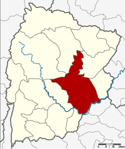
Amphoe Mueang Chaiyaphum
|
Mueang Chaiyaphum เมืองชัยภูมิ |
|
|---|---|
| Amphoe | |
 Amphoe location in Chaiyaphum Province |
|
| Coordinates: 15°48′25″N 102°1′54″E / 15.80694°N 102.03167°ECoordinates: 15°48′25″N 102°1′54″E / 15.80694°N 102.03167°E | |
| Country |
|
| Province | Chaiyaphum |
| Area | |
| • Total | 1,169.9 km2 (451.7 sq mi) |
| Population (2000) | |
| • Total | 184,921 |
| • Density | 158.1/km2 (409/sq mi) |
| Time zone | THA (UTC+7) |
| Postal code | 36000 |
| Geocode | 3601 |
Mueang Chaiyaphum (Thai: เมืองชัยภูมิ) is the capital district (Amphoe Mueang) of Chaiyaphum Province, northeastern Thailand.
The history of the city of Chaiyaphum dates back to the Dvaravati era. In the early of the Ayutthaya kingdom, Chaiyaphum was still controlled by the Lao Lan Xang kingdom. After the Ayutthaya kingdom conquered Vientiane, Laotians traveling through the area settled to form the town.
Around year 1817, Mr.Lae led a group of Laotian people from Vientaine across the Mekong river to find a new fertile area. They moved their towns many times, finally settled in the area of Ban Luang. King Anouvong of Lan Xang consulted to King Rama III to promote Mr.Lae to be Khun Phakdi Chumphon, later was promoted to be the governor of Chaiyaphum as Phraya Phakdi Chumphon. When King Anouvong declared war on Siam in an attempt to regain independence. Phraya Phakdi Chumphon changed allegiance and supported the Siamese troops, then he was killed by King Anouvong. When King Chulalongkorn reformed the government administration, Chaiyaphum was included to Monthon Nakhon Ratchasima.
Neighboring districts are (from the north clockwise) Kaset Sombun, Kaeng Khro and Khon Sawan of Chaiyaphum Province, Kaeng Sanam Nang and Ban Lueam of Nakhon Ratchasima Province, and Noen Sa-nga, Ban Khwao and Nong Bua Daeng.
...
Wikipedia
