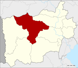
Amphoe Chom Bueng
|
Chom Bueng จอมบึง |
|
|---|---|
| Amphoe | |
 Amphoe location in Ratchaburi Province |
|
| Coordinates: 13°37′11″N 99°35′30″E / 13.61972°N 99.59167°ECoordinates: 13°37′11″N 99°35′30″E / 13.61972°N 99.59167°E | |
| Country |
|
| Province | Ratchaburi |
| Tambon | 6 |
| Muban | 90 |
| Area | |
| • Total | 772.1 km2 (298.1 sq mi) |
| Population (2015) | |
| • Total | 62,921 |
| • Density | 75.2/km2 (195/sq mi) |
| Time zone | THA (UTC+7) |
| Postal code | 70150 |
| Geocode | 7002 |
Chom Bueng (Thai: จอมบึง, pronounced [t͡ɕɔ̄ːm bɯ̄ŋ]) is a district (Amphoe) of Ratchaburi Province in western Thailand.
Neighboring districts are (from the north clockwise) Dan Makham Tia and Tha Muang of Kanchanaburi Province, and Photharam, Mueang Ratchaburi, Pak Tho, Ban Kha and Suan Phueng.
Several caves are located in the district. Khao Bin cave is regarded as the most beautiful one, having many stalactites and stalagmites and a holy pond. The cave is named after a rock formation which looks like a flying bird. Chomphon cave was renamed by King Chulalongkorn during his visit in the area in 1895, due to a stalactite looking like an epaulette of a field marshal.
In 1895 King Chulalongkorn and Queen Saovabha visited Ratchaburi Province, including the area of the district. The king saw a big beautiful lake there. He then named the area Big Lake or Chom Bueng, and made it to be a minor district (king amphoe).
In 1958 Chom Bueng was upgraded to be Amphoe Chom Bueng.
The district Chom Bueng is subdivided into 6 subdistricts (Tambon), which are further subdivided into 90 administrative villages (Muban).
...
Wikipedia
