Amity Township, Berks County, Pennsylvania
| Amity Township | |
|---|---|
| Township | |

|
|
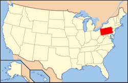
 Location of Pennsylvania in the United States |
|
| Location of Amity Township in Pennsylvania | |
| Coordinates: 40°17′30″N 75°45′29″W / 40.29167°N 75.75806°WCoordinates: 40°17′30″N 75°45′29″W / 40.29167°N 75.75806°W | |
| Country | United States |
| State | Pennsylvania |
| County | Berks |
| Area | |
| • Total | 18.4 sq mi (48 km2) |
| • Land | 18.3 sq mi (47 km2) |
| • Water | 0.1 sq mi (0.3 km2) |
| Elevation | 223 ft (68 m) |
| Population (2010) | |
| • Total | 12,583 |
| • Density | 680/sq mi (260/km2) |
| Time zone | EST (UTC-5) |
| • Summer (DST) | EDT (UTC-4) |
| Area code(s) | 610 |
Amity Township is a township in Berks County, Pennsylvania, United States. The population was 12,583 at the 2010 census. Amity Township, especially in the Douglassville area, is seeing growth in development.
The township was so named for the cordial relationship, or amity, between Swedish settlers and the local Native Americans.
The boundaries of Amity Township are almost identical to the boundaries of the original area known as Swedes’ tract. During December 1699, Lutheran pastor Andreas Rudman had met with Governor William Penn. Pastor Rudman pointed out that many of the residents of the former Swedish colony of New Sweden felt cheated by the preemption of their lands for Quaker settlement. Rudman secured an order from William Penn in October 1701 setting aside 10,000 acres (40 km2) up the Schuylkill River, near Manatawny Creek, for members of his congregation.
The George Douglass House, Griesemer-Brown Mill Complex, Old St. Gabriel's Episcopal Church, Old Swede's House, Rhoads-Lorah House and Barn, Weidner Mill, and White Horse Tavern are listed on the National Register of Historic Places.
According to the United States Census Bureau, the township has a total area of 18.4 square miles (48 km2), of which, 18.3 square miles (47 km2) of it is land and 0.1 square miles (0.26 km2) of it (0.60%) is water.
...
Wikipedia

