Amelia County, Virginia
| Amelia County, Virginia | ||
|---|---|---|

Amelia County Courthouse
|
||
|
||
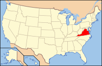
 Location in the U.S. state of Virginia |
||
 Virginia's location in the U.S. |
||
| Founded | 1735 | |
| Named for | Princess Amelia | |
| Seat | Amelia | |
| Area | ||
| • Total | 359 sq mi (930 km2) | |
| • Land | 355 sq mi (919 km2) | |
| • Water | 3.3 sq mi (9 km2), 0.9% | |
| Population (est.) | ||
| • (2015) | 12,903 | |
| • Density | 35/sq mi (13.7/km²) | |
| Congressional district | 4th | |
| Time zone | Eastern: UTC-5/-4 | |
| Website | www |
|
Amelia County is a United States county located just west of Richmond in the Commonwealth of Virginia. The county is included in the Greater Richmond Region, and its county seat is Amelia Courthouse.
Amelia County was created in 1735 from parts of Prince George and Brunswick counties, and it was named in honor of Princess Amelia of Great Britain. Parts of the county were later carved out to create Prince Edward and Nottoway counties.
As of the 2010 census, the county population was 12,690, which is an increase of over 44 percent from the 1990 census. The largest individual ancestry group in Amelia is African Americans at 28% of the total population.
Amelia County was created by a legislative act in 1734 and 1735 from parts of Prince George and Brunswick counties. The County is named for Princess Amelia of Great Britain, daughter of King George II. Twice Amelia County was reduced in size to form newer counties; in 1754, Prince Edward County was formed from parts of Amelia County, and in 1789, Nottoway County was formed.
During the Civil War General Robert E. Lee and his Army spent April 4 and 5, 1865 at Amelia Courthouse before his surrender to General Ulysses S. Grant at Appomattox. The last major battle of the war was fought at Sayler’s Creek on April 6.
...
Wikipedia

