Amba Alagi
| Amba Alagi | |
|---|---|

Alagi Amba, near Attala. Photograph taken by 10th Company, RE
|
|
| Highest point | |
| Elevation | 3,438 m (11,280 ft) |
| Coordinates | 12°59′39″N 39°30′13″E / 12.99417°N 39.50361°ECoordinates: 12°59′39″N 39°30′13″E / 12.99417°N 39.50361°E |
| Geography | |
| Location | Debubawi (Southern) Zone, Tigray Region, Ethiopia |
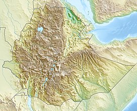
Amba Alagi is a mountain, or an amba, in northern Ethiopia. Located in the Debubawi Zone of the Tigray Region, Amba Alagi dominates the roadway that runs past it from the city of Mek'ele south to Maychew. Because of its strategic location, Amba Alagi has been the location of several battles. As Anthony Mockler describes it,
The first mention of Amba Alagi is in the Chronicle of Emperor Baeda Maryam (1468–1478 AD), who personally led an expedition against the Dobe'a, who lived around Amba Alagi and raided the caravan routes. In the early 19th century, Ras Wolde Selassie controlled the amba, and used it on 18 August 1811 to imprison Gebre Guro, the brother of Sabagadis, for 18 months because he had rebelled against the Ras. The road built from the coast south to Magdala during the British 1868 Expedition to Abyssinia passed through Amba Alagi. A generation later, the mountain was the scene of a battle in February 1889 between Ras Alula Engida and Ras Seyoum Gebre in which Alula was wounded.
The first Battle of Amba Alagi occurred in December 1895. On December 7, the Ethiopians defeated an Italian army of 2,350 led by Pietro Toselli and a day later, on December 8, the Ethiopian emperor, Menelik II, drove out the Italian forces of General Oreste Baratieri. After the defeat, the Italians withdrew from Amba Alagi and Gondar to their half-finished fort at Mek'ele, which Menelik then besieged for 15 days (6–21 January 1896).
...
Wikipedia

