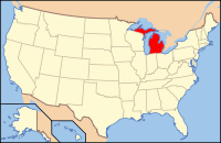
Alpena County, MI
| Alpena County, Michigan | ||
|---|---|---|

|
||
|
||
 Location in the U.S. state of Michigan |
||
 Michigan's location in the U.S. |
||
| Founded | February 7, 1857 | |
| Seat | Alpena | |
| Largest city | Alpena | |
| Area | ||
| • Total | 1,695 sq mi (4,390 km2) | |
| • Land | 572 sq mi (1,481 km2) | |
| • Water | 1,123 sq mi (2,909 km2), 66% | |
| Population | ||
| • (2010) | 29,598 | |
| • Density | 66/sq mi (25/km2) | |
| Congressional district | 1st | |
| Time zone | Eastern: UTC−5/−4 | |
| Website | www |
|
Alpena County is a county in the U.S. state of Michigan. As of the 2010 census, the population was 29,598. The county seat is Alpena. It is considered to be part of Northern Michigan.
Alpena County comprises the Alpena, MI Micropolitan Statistical Area.
The county was created by the Michigan Legislature in 1840 as Anamickee County, then renamed in 1843 to Alpena County, a pseudo-Native American word — a neologism coined by Henry Schoolcraft, meaning "a good partridge country." This was part of a much larger effort to rename a great many of the Michigan counties at the time. It was officially organized in 1857.
According to the U.S. Census Bureau, the county has a total area of 1,695 square miles (4,390 km2), of which 572 square miles (1,480 km2) is land and 1,123 square miles (2,910 km2) (66%) is water.
Alpena County is in the northeast of the mitten-shaped Lower Peninsula of Michigan. Lake Huron and Thunder Bay are to the east, Alcona County to the south, Oscoda County to the southwest, Montmorency County to the west, and Presque Isle County to the north. Most of the county is drained by the Thunder Bay River and its tributaries. The Mackinaw State Forest occupies large tracts of land in the county. The Thunder Bay National Marine Sanctuary is offshore adjacent to the county.
...
Wikipedia

