Alma, Wisconsin
| Alma, Wisconsin | |
|---|---|
| City | |

Alma at the 1935 dedication of Lock and Dam No. 4
|
|
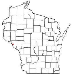
 Location of Alma, Wisconsin |
|
| Coordinates: 44°20′24″N 91°55′28″W / 44.34000°N 91.92444°WCoordinates: 44°20′24″N 91°55′28″W / 44.34000°N 91.92444°W | |
| Country | United States |
| State | Wisconsin |
| County | Buffalo |
| Government | |
| Area | |
| • Total | 7.91 sq mi (20.49 km2) |
| • Land | 5.27 sq mi (13.65 km2) |
| • Water | 2.64 sq mi (6.84 km2) |
| Elevation | 673 ft (205 m) |
| Population (2010) | |
| • Total | 781 |
| • Estimate (2012) | 764 |
| • Density | 148.2/sq mi (57.2/km2) |
| Time zone | Central (CST) (UTC-6) |
| • Summer (DST) | CDT (UTC-5) |
| Zip Code | 54610 |
| Area code(s) | 608 |
| FIPS code | 55-01225 |
| GNIS feature ID | 1560795 |
| Website | cityofalmawi |
Alma is a city in and the county seat of Buffalo County in the U.S. state of Wisconsin. The population was 781 at the 2010 census. The city borders the Town of Alma (to its east), as well as the Town of Nelson (to its north), the Town of Belvidere (to its southeast), and Greenfield Township, Wabasha County, Minnesota (across the Mississippi River to its west). The motto for the city of Alma is: "Step into Living History."
Alma was named in commemoration of the Battle of Alma, in the Crimean War.
Alma is located on State Route 35. Is about 6 miles (9.7 km) east of Wabasha, Minnesota.
According to the United States Census Bureau, the city has a total area of 7.91 square miles (20.49 km2), of which, 5.27 square miles (13.65 km2) is land and 2.64 square miles (6.84 km2) is water.
As of the census of 2010, there were 781 people, 386 households, and 202 families residing in the city. The population density was 148.2 inhabitants per square mile (57.2/km2). There were 488 housing units at an average density of 92.6 per square mile (35.8/km2). The racial makeup of the city was 98.5% White, 0.1% African American, 0.4% Native American, 0.1% Asian, and 0.9% from two or more races. Hispanic or Latino of any race were 0.6% of the population.
...
Wikipedia
