Wabasha, Minnesota
| Wabasha, Minnesota | |
|---|---|
| City | |

Downtown Wabasha
|
|
| Motto: "Governor's Fit City" | |
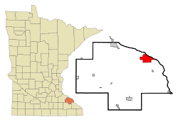
 Location of the city of Wabasha within Wabasha County in the state of Minnesota |
|
| Coordinates: 44°22′46″N 92°2′8″W / 44.37944°N 92.03556°W | |
| Country | United States |
| State | Minnesota |
| County | Wabasha |
| Area | |
| • Total | 9.27 sq mi (24.01 km2) |
| • Land | 8.22 sq mi (21.29 km2) |
| • Water | 1.05 sq mi (2.72 km2) |
| Elevation | 686 ft (209 m) |
| Population (2010) | |
| • Total | 2,521 |
| • Estimate (2012) | 2,502 |
| • Density | 306.7/sq mi (118.4/km2) |
| Time zone | Central (CST) (UTC-6) |
| • Summer (DST) | CDT (UTC-5) |
| ZIP code | 55981 |
| Area code(s) | 651 |
| FIPS code | 27-67378 |
| GNIS feature ID | 0653695 |
| Website | www.wabasha.org |
Wabasha is a city in Wabasha County, Minnesota, United States. The population was 2,521 at the 2010 census. Located on the Mississippi River near its confluence with the Chippewa River, it is the county seat.
Wabasha is named after the Mdewakanton Dakota mixed-blood (with Anishinaabe) chiefs Wapi-sha, or red leaf (wáȟpe šá - leaf red), father (1718–1806), son (1768–1855), and grandson (±1816-1876) of the same name. The second, Wabishaw the son, signed the 1830 USA treaty with the "Confederated Tribes of the Sacs and Foxes; the Medawah-Kanton, Wahpacoota, Wahpeton and Sissetong Bands or Tribes of Sioux; the Omahas, Ioways, Ottoes and Missourias" in Prairie du Chien. The grandson, Wabasha III (±1816-1876), signed the 1851 and 1858 treaties that ceded the southern half of what is now the state of Minnesota to the United States, beginning the removal of his band to the Minnesota River, then removal from Minnesota to Crow Creek Reservation in Dakota Territory, then lastly to the Santee Reservation in Nebraska, where the last chief Wabasha died.
Wabasha was platted in 1854.
According to the United States Census Bureau, the city has a total area of 9.27 square miles (24.01 km2); 8.22 square miles (21.29 km2) is land and 1.05 square miles (2.72 km2) is water. U.S. Highway 61 and Minnesota Highway 60 are two of the main routes in the city. Wisconsin Highways 25 and 35 are nearby.
...
Wikipedia
