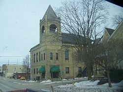
Alma, Ontario
| Mapleton | |
|---|---|
| Township (lower-tier) | |
| Township of Mapleton | |

Drayton
|
|
 Location of Mapleton within Wellington County |
|
| Location of Mapleton in southern Ontario | |
| Coordinates: 43°45′00″N 80°40′00″W / 43.75°N 80.6667°WCoordinates: 43°45′00″N 80°40′00″W / 43.75°N 80.6667°W | |
| Country |
|
| Province |
|
| County | Wellington |
| Established | 1999 |
| Government | |
| • Type | Township |
| • Mayor | S. Neil Driscoll |
| • Governing Body | Mapleton Township Council |
| • Federal riding | Perth—Wellington |
| • Prov. riding | Perth—Wellington |
| Area | |
| • Land | 534.81 km2 (206.49 sq mi) |
| Population (2011) | |
| • Total | 9,989 |
| • Density | 18.7/km2 (48/sq mi) |
| Time zone | EST (UTC-5) |
| • Summer (DST) | EDT (UTC-4) |
| Postal Code FSA | N0B |
| Area code(s) | 519 and 226 |
| Website | www.mapleton.ca |
Mapleton is a township in the Canadian province of Ontario, located within Wellington County.
The largest and central community in Mapleton is the village of Drayton, which contains the township offices and has the largest retail presence.
The township also contains the smaller communities of Alma, Bosworth, Creek Bank, Dobbenville, Glen Allan, Goldstone, Hollen, Moorefield, Parker, Quarindale, Riverbank, Rothsay, Spruce Green and Wyandot.
The township was formed by the amalgamation of the townships of Maryborough and Peel, and the village of Drayton on January 1, 1999.
Population trend:
Mapleton is served by four public schools, administered by the Upper Grand District School Board. These are:
Secondary education is served by Norwell District Secondary School in Palmerston, in the adjacent township of Minto.
Mapleton is also served by one independent school
...
Wikipedia

