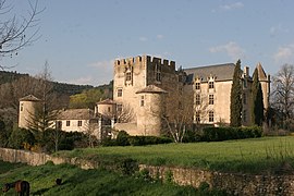
Allemagne-en-Provence
| Allemagne-en-Provence | ||
|---|---|---|

Castle
|
||
|
||
| Coordinates: 43°46′59″N 6°00′28″E / 43.7831°N 6.0078°ECoordinates: 43°46′59″N 6°00′28″E / 43.7831°N 6.0078°E | ||
| Country | France | |
| Region | Provence-Alpes-Côte d'Azur | |
| Department | Alpes-de-Haute-Provence | |
| Arrondissement | Digne-les-Bains | |
| Canton | Valensole | |
| Intercommunality | Durance Luberon Verdon | |
| Government | ||
| • Mayor (2014-2020) | Jean-Luc Zerbone | |
| Area1 | 32.99 km2 (12.74 sq mi) | |
| Population (2014)2 | 525 | |
| • Density | 16/km2 (41/sq mi) | |
| Time zone | CET (UTC+1) | |
| • Summer (DST) | CEST (UTC+2) | |
| INSEE/Postal code | 04004 /04500 | |
| Elevation | 389–622 m (1,276–2,041 ft) (avg. 421 m or 1,381 ft) |
|
|
1 French Land Register data, which excludes lakes, ponds, glaciers > 1 km² (0.386 sq mi or 247 acres) and river estuaries. 2Population without double counting: residents of multiple communes (e.g., students and military personnel) only counted once. |
||
1 French Land Register data, which excludes lakes, ponds, glaciers > 1 km² (0.386 sq mi or 247 acres) and river estuaries.
Allemagne-en-Provence is a commune in the Alpes-de-Haute-Provence department in the Provence-Alpes-Côte d'Azur region in southeastern France.
Unlike the other French town called Allemagne, which changed its name to Fleury-sur-Orne in 1916 during World War I, Allemagne-en-Provence has kept its name.
The inhabitants are called Armagnois or Allemagniens (not Allemands French: Germans).
Allemagne-en-Provence is located about 50 km northeast of Aix-en-Provence and 25 km west of Castellane. Access to the commune is by road D952 east from Saint-Martin-de-Bromes to the town then continuing northeast to Riez. There is also road D111 starting from the town and going east to Montagnac-Montpezat. Road D15 also follows a convoluted route south from Valensole to the town. There is a network of small country roads covering the commune. About 30% of the land is farmland with the rest mountain slopes and forests.
The commune is located at the confluence of the Montagnac torrent and the Colostre river, 36.3 km long, which flows southwest into the Verdon river. There is a large network of streams feeding into the Colostre throughout the commune.
In the 19th century, the village was frequently inundated by floods caused by storms with floods sweeping down the mountain and swamping the village streets.
All of the 200 communes of the department are in a seismic risk area. The canton of Riez to which the commune belongs is zone 1b (low risk) according to the deterministic classification of 1991 based on historical earthquakes; and Zone 3 (moderate risk) according to the classification probability EC8 of 2011. The commune also faces exposure to three other natural hazards:
...
Wikipedia


