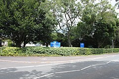
Alder Row
| Selwood | |
|---|---|
 Selwood Academy School |
|
| Selwood shown within Somerset | |
| Population | 798 (2011) |
| OS grid reference | ST787486 |
| District | |
| Shire county | |
| Region | |
| Country | England |
| Sovereign state | United Kingdom |
| Post town | FROME |
| Postcode district | BA11 0 |
| Dialling code | 01373 |
| Police | Avon and Somerset |
| Fire | Devon and Somerset |
| Ambulance | South Western |
| EU Parliament | South West England |
| UK Parliament | |
Selwood used to be a village but is now part of the suburbs of Frome. It is a civil parish in the Mendip district of Somerset, England. The parish includes the villages of East and West Woodlands, Rodden and the hamlets of Alder Row and Blatchbridge.
The name Selwood is first recorded in Old English around 894 as Seluudu which some etymologists consider to derive from Sealhwudu or Sallow wood.
Roddenbury Hillfort is a univallate Iron Age hill fort. It is a Scheduled Ancient Monument and on the Heritage at Risk register.
Selwood Forest is an area of woodland on the borders between Somerset, Dorset and Wiltshire in south west England. In Anglo-Saxon times it was far more substantial and covered a much greater area forming a natural barrier between the Anglo-Saxons of Wessex and the Britons of Dumnonia and the Severn Valley. It was also the site of Hales Castle.
...
Wikipedia

