Alberta, Virginia
| Alberta, Virginia | |
|---|---|
| Town | |
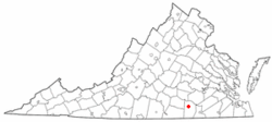
 Location of Alberta, Virginia |
|
| Coordinates: 36°51′49″N 77°52′53″W / 36.86361°N 77.88139°WCoordinates: 36°51′49″N 77°52′53″W / 36.86361°N 77.88139°W | |
| Country | United States |
| State | Virginia |
| County | Brunswick |
| Area | |
| • Total | 2.15 sq mi (5.56 km2) |
| • Land | 2.14 sq mi (5.53 km2) |
| • Water | 0.01 sq mi (0.03 km2) |
| Elevation | 397 ft (121 m) |
| Population (2010) | |
| • Total | 298 |
| • Density | 140/sq mi (53.9/km2) |
| Time zone | Eastern (EST) (UTC-5) |
| • Summer (DST) | EDT (UTC-4) |
| ZIP code | 23821 |
| Area code(s) | 434 |
| FIPS code | 51-00724 |
| GNIS feature ID | 1498398 |
| Website | www |
Alberta is a town in Brunswick County, Virginia, United States. The population was 298 at the 2010 census. It is home to the Christanna Campus of Southside Virginia Community College.
Hobson's Choice and Rocky Run Methodist Church are listed on the National Register of Historic Places.
Alberta is located in north-central Brunswick County along U.S. Route 1. Interstate 85 passes south of the original portion of the town, with access from Exit 28. The town limits extend southwest along Route 1 and I-85 to Virginia State Route 46 and Southside Virginia Community College, with access from I-85 to VA 46 from Exit 27. Via I-85 it is 40 miles (64 km) northeast to Petersburg and 16 miles (26 km) southwest to South Hill.
According to the United States Census Bureau, Alberta has a total area of 2.15 square miles (5.56 km2), of which 2.14 square miles (5.53 km2) is land and 0.01 square miles (0.03 km2), or 0.61%, is water.
As of the census of 2000, there were 306 people, 128 households, and 86 families residing in the town. The population density was 278.3 people per square mile (107.4/km²). There were 158 housing units at an average density of 143.7 per square mile (55.5/km²). The racial makeup of the town was 59.80% White, 39.54% African American, 0.33% Asian, 0.33% from other races. Hispanic or Latino of any race were 0.33% of the population.
...
Wikipedia
