Albany Township, Berks County, PA
| Albany Township | |
|---|---|
| Township | |

A farm in Albany Township
|
|
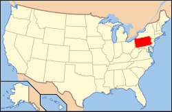
 Location of Pennsylvania in the United States |
|
| Location of Albany Township in Pennsylvania | |
| Coordinates: 40°37′41″N 75°53′14″W / 40.62806°N 75.88722°WCoordinates: 40°37′41″N 75°53′14″W / 40.62806°N 75.88722°W | |
| Country | United States |
| State | Pennsylvania |
| County | Berks |
| Area | |
| • Total | 40.2 sq mi (104 km2) |
| • Land | 40.2 sq mi (104 km2) |
| • Water | 0.0 sq mi (0 km2) |
| Elevation | 515 ft (157 m) |
| Population (2010) | |
| • Total | 1,724 |
| • Estimate (2016) | 1,728 |
| • Density | 43/sq mi (17/km2) |
| Time zone | EST (UTC-5) |
| • Summer (DST) | EDT (UTC-4) |
| Area code(s) | 610 |
Albany Township is a township in Berks County, Pennsylvania, United States. The population was 1,724 at the 2010 census. The township hall is located in Kempton.
According to the United States Census Bureau, the township has a total area of 40.2 square miles (104 km2), all of it land. It is in the Schuylkill watershed and the northern and western portions are on Blue Mountain. Its villages include Albany, Eckville, Greenawald, Kempton, Stony Run, and Trexler.
Adjacent townships
As of the census of 2010, there were 1,724 people, 667 households, and 489 families residing in the township. The population density was 42.9 people per square mile. There were 721 housing units at an average density of 17.9/sq mi . The racial makeup of the township was 98.6% White, 0.5% African American, 0.1% Asian, 0.1% from other races, and 0.6% from two or more races. Hispanic or Latino of any race were 1.4% of the population.
...
Wikipedia

