Agia Varvara
|
Agia Varvara Αγία Βαρβάρα |
|
|---|---|

Prophet Elias church in Agia Barbara
|
|
| Coordinates: 38°00′N 23°39′E / 38.000°N 23.650°ECoordinates: 38°00′N 23°39′E / 38.000°N 23.650°E | |
| Country | Greece |
| Administrative region | Attica |
| Regional unit | West Athens |
| Government | |
| • Mayor | Georgios Kaplanis (PASOK/DIMAR) |
| Area | |
| • Municipality | 2.425 km2 (0.936 sq mi) |
| Elevation | 70 m (230 ft) |
| Population (2011) | |
| • Municipality | 26,550 |
| • Municipality density | 11,000/km2 (28,000/sq mi) |
| Time zone | EET (UTC+2) |
| • Summer (DST) | EEST (UTC+3) |
| Postal code | 123 xx |
| Area code(s) | 210 |
| Vehicle registration | Z |
| Website | www.agiavarvara.gr |
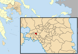
Agia Varvara (Greek: Αγία Βαρβάρα, meaning Saint Barbara) is a suburb in the western part of Athens, Greece.
Agia Varvara is situated east of the mountain Aigaleo. It is 6 km (4 mi) west of central Athens and 5 km (3 mi) north of Piraeus. The municipality has an area of 2.425 km2. Since December 2013, it is served by the Agia Marina station of the Athens Metro.
...
Wikipedia


