Aegerten
| Aegerten | |
|---|---|
 |
|
| Coordinates: 47°7′N 7°17′E / 47.117°N 7.283°ECoordinates: 47°7′N 7°17′E / 47.117°N 7.283°E | |
| Country | Switzerland |
| Canton | Bern |
| District | Biel/Bienne |
| Government | |
| • Mayor | Fredi Siegenthaler |
| Area | |
| • Total | 2.17 km2 (0.84 sq mi) |
| Elevation | 437 m (1,434 ft) |
| Population (Dec 2015) | |
| • Total | 1,874 |
| • Density | 860/km2 (2,200/sq mi) |
| Postal code | 2558 |
| SFOS number | 0731 |
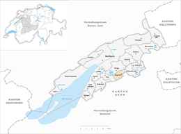
| Surrounded by | Studen, Jens, Port, Brügg, Schwadernau |
| Website |
www SFSO statistics |
Aegerten is a municipality in the Biel/Bienne administrative district of the canton of Bern in Switzerland.
Aegerten is first mentioned in 1225 as villa Egerdon.
There has been a village here since at least the late-Roman era. It lay on the major Roman road from Aventicum to Petinesca over the Pierre-Pertuis pass to Basel. A bridge was built across Zihl river by 368-69. The ruins of the bridge have been discovered beneath the Bürglen village church and on the banks of the Flur island in the river. Very little is known about the village after the collapse of the Roman Empire until the Late Middle Ages. By the late medieval era, Gottstatt Abbey was the major landholder in the village. In 1388, the city of Bern acquired the village and in 1393 incorporated it into the Nidau bailiwick and the Bürglen parish. Aegerten remained a small, agrarian village until the 18th century, when shipping on the Zihl river and seasonal work in the Principality of Neuchâtel began to provide additional income. Despite four bridges, the village remained isolated from the growing Swiss rail and road networks in the 19th and early 20th century. As the nearby town of Biel grew in the 1950s, Aegerten finally began to develop into a commuter town and was connected into the Swiss Federal Railways network.
Aegerten has an area of 2.17 km2 (0.84 sq mi). As of 2012, a total of 0.81 km2 (0.31 sq mi) or 37.3% is used for agricultural purposes, while 0.61 km2 (0.24 sq mi) or 28.1% is forested. Of the rest of the land, 0.63 km2 (0.24 sq mi) or 29.0% is settled (buildings or roads), 0.11 km2 (27 acres) or 5.1% is either rivers or lakes.
...
Wikipedia


