A17 road (Great Britain)
| A17 road | |
|---|---|
 |
|
| Major junctions | |
| From: |
Newark-on-Trent 53°05′41″N 0°47′00″W / 53.0946°N 0.7833°W |
|
|
|
| To: |
Kings Lynn 52°44′33″N 0°22′44″E / 52.7426°N 0.3790°E |
| Location | |
|
Primary destinations: |
Sleaford |
| Road network | |
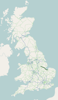
The A17 road is a road linking Newark-on-Trent in Nottinghamshire, England, to King's Lynn in Norfolk. It stretches for a distance of 62 miles travelling across the flat Fen landscapes of southern Lincolnshire and western Norfolk.
The A17 is a major route for HGV's accessing Norfolk from Northern England and the Midlands and also a major holiday route in the summer months for cars and caravans making their way to the seaside resorts of Hunstanton, Wells-next-the-Sea, Sheringham, Cromer and Great Yarmouth and is one of only two direct routes that links Norfolk with the A1, the other being the A47. The A17 has very few stretches of dual-carriageway (four in total) with the longest being the Sleaford bypass which is 3 miles (4.8 km) long with the second longest at Beckingham which is just 1⁄2 mile (0.80 km) long and the other two stretches are located at roundabouts in Long Sutton and Sutton Bridge both of which are under 1⁄4 mile (0.40 km) long, although in addition there are several stretches of dual carriageway at junctions. It is one of two main routes for residents of East Anglia to get to the North of England (and vice versa) - the other is the A47 via Peterborough, which is a longer route but much more dual-carriageway.
...
Wikipedia

