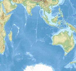
2012 Indian Ocean earthquakes
| Date | 11 April 2012 |
|---|---|
| Origin time | 08:38:36 |
| Magnitude | 8.6 Mw |
| Epicenter | 2°18′40″N 93°03′47″E / 2.311°N 93.063°ECoordinates: 2°18′40″N 93°03′47″E / 2.311°N 93.063°E |
| Type | Strike-slip – Intraplate |
| Areas affected | Indonesia |
| Max. intensity | VII (Very strong) |
| Tsunami | Yes |
| Foreshocks | 7.2 Mw Jan 10 at 18:36 |
| Aftershocks | 8.2 Mw April 11 at 10:43 |
| Casualties | 10 dead 12 injured |
The 2012 Indian Ocean earthquakes were magnitude 8.6 and 8.2 Mw undersea earthquakes that struck near the Indonesian province of Aceh on 11 April at 15:38 local time. Initially, authorities feared that the initial earthquake would cause a tsunami and warnings were issued across the Indian Ocean; however, these warnings were subsequently cancelled. These were unusually strong intraplate earthquakes and the largest strike-slip earthquake ever recorded.
The 2012 earthquake's epicenter was located within the Indo-Australian Plate, which is divided into two sub- or proto-plates: the Indian, and Australian. At their boundary, the Indian and Australian Plates converge at 11 mm (0.4 in) per year in a NNW–SSE direction. This convergence is accommodated by a broad zone of deformation. As part of that intraplate deformation, north–south trending fracture zones have been reactivated from the Ninety East Ridge as far east as 97°E.
The Indo–Australian Plate was formed after the amalgamation of the Indian Plate and the Australian Plate some 45 million years ago. However, there is a relative movement between the Indian Plate and the Australian Plate. A process which would eventually split the Indo-Australian Plate in two probably have started 8 to 10 millions ago and is still taking place. Because of the deformation, fracture zones have been reactivated. The 2012 Indian Ocean earthquake is associated to the reactivation of the NNE-striking sea floor fabric.
The magnitude 8.6 (Mw) earthquake occurred about 610 km (379 mi) southwest of Banda Aceh, Indonesia at 08:38 UTC on 11 April 2012. The earthquake occurred at a depth of 22.9 km (14.2 mi), which is considered relatively shallow according to the scale used by the United States Geological Survey (USGS). The quake was originally reported as a magnitude 8.9, but was later downgraded to 8.6. It was felt as far away as Malaysia, the Maldives and in India. The earthquake was caused by a strike-slip motion. The earthquake and the largest aftershock had a fault displacement of 21.3 m (70 ft). The strike-slip nature of the earthquake meant that the movement displaced relatively little seawater and was less likely to cause a tsunami.
...
Wikipedia

