1997–98 Australian region cyclone season
| 1997–98 Australian region cyclone season | |
|---|---|

Season summary map
|
|
| Seasonal boundaries | |
| First system formed | 19 November 1997 |
| Last system dissipated | 19 April 1998 |
| Strongest storm | |
| Name | Tiffany |
| • Maximum winds | 170 km/h (105 mph) (10-minute sustained) |
| • Lowest pressure | 940 hPa (mbar) |
| Seasonal statistics | |
| Tropical cyclones | 10 official, 1 unofficial |
| Tropical cyclones | 4 |
| Total fatalities | Unknown |
| Total damage | Unknown |
| Related articles | |
| Category 2 tropical cyclone (Australian scale) | |
| Category 1 tropical cyclone (SSHWS) | |
| Duration | 19 November – 21 November |
|---|---|
| Peak intensity | 110 km/h (70 mph) (10-min) 975 hPa (mbar) |
| Category 2 tropical cyclone (Australian scale) | |
| Tropical storm (SSHWS) | |
| Duration | 24 December – 29 December |
|---|---|
| Peak intensity | 95 km/h (60 mph) (10-min) 985 hPa (mbar) |
| Category 3 severe tropical cyclone (Australian scale) | |
| Category 1 tropical cyclone (SSHWS) | |
| Duration | 26 December – 2 January |
|---|---|
| Peak intensity | 140 km/h (85 mph) (10-min) 960 hPa (mbar) |
| Category 4 severe tropical cyclone (Australian scale) | |
| Category 2 tropical cyclone (SSHWS) | |
| Duration | 1 January – 24 January |
|---|---|
| Peak intensity | 165 km/h (100 mph) (10-min) 940 hPa (mbar) |
| Category 4 severe tropical cyclone (Australian scale) | |
| Category 4 tropical cyclone (SSHWS) | |
| Duration | 22 January – 31 January |
|---|---|
| Peak intensity | 170 km/h (105 mph) (10-min) 940 hPa (mbar) |
| Category 2 tropical cyclone (Australian scale) | |
| Tropical storm (SSHWS) | |
| Duration | 22 January – 1 February |
|---|---|
| Peak intensity | 110 km/h (70 mph) (10-min) 976 hPa (mbar) |
| Category 3 severe tropical cyclone (Australian scale) | |
| Category 2 tropical cyclone (SSHWS) | |
| Duration | 8 February – 17 February (Exited basin) |
|---|---|
| Peak intensity | 120 km/h (75 mph) (10-min) 970 hPa (mbar) |
| Category 1 tropical cyclone (Australian scale) | |
| Tropical storm (SSHWS) | |
| Duration | 25 February – 26 February |
|---|---|
| Peak intensity | 75 km/h (45 mph) (10-min) 990 hPa (mbar) |
| Tropical low (Australian scale) | |
| Duration | 7 March – 9 March (crossed basin) |
|---|---|
| Peak intensity | 35 km/h (25 mph) (10-min) |
The 1997–98 Australian region cyclone season was an event in the ongoing cycle of tropical cyclone formation. It ran from 1 November 1997 to 30 April 1998. The regional tropical cyclone operational plan also defines a tropical cyclone year separately from a tropical cyclone season, and the "tropical cyclone year" ran from 1 July 1997 to 30 June 1998.
Tropical cyclones in this area were monitored by four Tropical Cyclone Warning Centres (TCWCs): the Australian Bureau of Meteorology in Perth, Darwin, and Brisbane; and TCWC Port Moresby in Papua New Guinea.
On 19 November, TCWC Brisbane and the JTWC reported that Cyclone Nute had crossed 160°E and moved into the Australian region at its peak intensities.
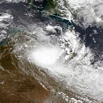
A low-pressure system formed over the Northern Territory in late December and moved into the Timor Sea as the monsoon trough developed near Australia. A tropical depression had formed on 26 December near Darwin, Australia. The storm reached gale force six hours after developing and was named Sid by the Tropical Cyclone Warning Center in Darwin. Sid moved to the east, affecting the Northern Territory. Sid turned southeastward, crossing the Northern Territory. Sid moved fully southward, in which it weakened due to wind shear. By 28 December, Sid had weakened to below gale-status and residual low meandered around for a few days.
By 3 January, the low re-entered the Western Gulf and the TCWC in Darwin began to re-issue advisories on the low, which was forecast to re-intensify. The low became a depression and drifted around for another day. On 4 January, scatterometer data at 1330 UTC indicated the presence of 30-35 mph winds over the water. The depression weakened back into a low on 5 January and advisories were stopped again. However, on 7 January, the TCWC in Darwin re-issued advisories for a third time and the cyclone was forecast to re-intensify, but this did not occur. The last warning was issued on the depression at 1800 UTC. The remnant low moved into the Gulf of Carpentaria and across Queensland. The TCWC in Brisbane, Australia issued bulletins on 10 January for the low which was once Sid. The low remained quasi-stationary to a couple of days near Townsville, causing major flooding in the area. The bulletins were discontinued the next day. Heavy rains fell and several rivers flooded due to the remnant low on 11 January.
...
Wikipedia


