1996–97 Australian region cyclone season
| 1996–97 Australian region cyclone season |

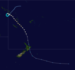
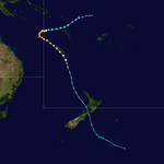
Season summary map
|
| Seasonal boundaries |
| First system formed |
July 9, 1996 |
| Last system dissipated |
May 16, 1997 |
| Strongest storm |
|
| Name |
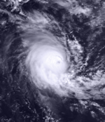
Pancho-Helinda |
| • Maximum winds |
205 km/h (125 mph)
(10-minute sustained) |
| • Lowest pressure |
910 hPa (mbar) |
| Seasonal statistics |
| Total fatalities |
Unknown |
| Total damage |
Unknown |
| Related articles |
|
|
Australian region tropical cyclone seasons
1994–95, 1995–96, 1996–97, 1997–98, 1998–99
|
| Category 1 tropical cyclone (Australian scale) |
| Tropical storm (SSHWS) |
|
|
| Duration |
9 July – 13 July |
| Peak intensity |
75 km/h (45 mph) (10-min) 990 hPa (mbar) |
| Category 2 tropical cyclone (Australian scale) |
| Tropical storm (SSHWS) |
|
|
| Duration |
28 October – 1 November |
| Peak intensity |
95 km/h (60 mph) (10-min) 990 hPa (mbar) |
| Category 1 tropical cyclone (Australian scale) |
| Tropical storm (SSHWS) |
|
|
| Duration |
12 December – 15 December |
| Peak intensity |
85 km/h (50 mph) (10-min) 985 hPa (mbar) |
| Category 2 tropical cyclone (Australian scale) |
| Tropical storm (SSHWS) |
|
|
| Duration |
13 December – 19 December |
| Peak intensity |
100 km/h (65 mph) (10-min) 980 hPa (mbar) |
| Category 2 tropical cyclone (Australian scale) |
| Category 1 tropical cyclone (SSHWS) |
|
|
| Duration |
23 December – 25 December |
| Peak intensity |
110 km/h (70 mph) (10-min) 975 hPa (mbar) |
| Category 2 tropical cyclone (Australian scale) |
| Category 2 tropical cyclone (SSHWS) |
|
|
| Duration |
26 December – 3 January |
| Peak intensity |
110 km/h (70 mph) (10-min) 975 hPa (mbar) |
| Category 3 severe tropical cyclone (Australian scale) |
| Category 1 tropical cyclone (SSHWS) |
|
|
| Duration |
2 January – 10 January |
| Peak intensity |
130 km/h (80 mph) (10-min) 965 hPa (mbar) |
| Category 4 severe tropical cyclone (Australian scale) |
| Category 4 tropical cyclone (SSHWS) |
|
|
| Duration |
4 January – 6 January |
| Peak intensity |
170 km/h (105 mph) (10-min) 935 hPa (mbar) |
| Category 5 severe tropical cyclone (Australian scale) |
| Category 4 tropical cyclone (SSHWS) |
|
|
| Duration |
18 January – 22 January |
| Peak intensity |
205 km/h (125 mph) (10-min) 910 hPa (mbar) |
The 1996–97 Australian region cyclone season was an event in the ongoing cycle of tropical cyclone formation. It ran from 1 November 1996 to 30 April 1996. The regional tropical cyclone operational plan also defines a tropical cyclone year separately from a tropical cyclone season, and the "tropical cyclone year" ran from 1 July 1996 to 30 June 1997.
Tropical cyclones in this area were monitored by four Tropical Cyclone Warning Centres (TCWCs): the Australian Bureau of Meteorology in Perth, Darwin, and Brisbane; and TCWC Port Moresby in Papua New Guinea.
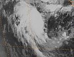
On 9 July, TCWC Perth reported that a tropical low had developed within the Near-equatorial trough of low pressure, located about 500 km (310 mi) to the northeast of the Cocos Islands. During that day the system moved to the southwest around a weak mid-upper level anticyclone, before it came under the starting to move southwards during 10 July. At 1000 UTC that day, TCWC Perth reported that the low had developed into a category one tropical cyclone, and named it Lindsay as the system reached its peak 10-minute sustained windspeeds of 75 km/h (45 mph). At 1500 UTC, the JTWC reported that Lindsay was becoming better organized and issued a tropical cyclone formation alert on the system. Six hours later while Lindsay was at its 1-minute peak intensity of 65 km/h (40 mph), the JTWC designated the system Tropical Cyclone 01S and started to issue warnings on it. After the JTWC had initiated warnings on the system, it began to rapidly weaken as it came under the influence of strong upper level north-westerlies. During the next day, both the JTWC and TCWC Perth issued their final advisories on Lindsay as it weakened below cyclone intensity and became extratropical. Lindsay's remnants were tracked as they moved towards the southeast until they were absorbed into a broad trough of low pressure on 13 July.
...
Wikipedia


