1970 Pacific typhoon season
| 1970 Pacific typhoon season |

Season summary map
|
| Seasonal boundaries |
| First system formed |
February 19, 1970 |
| Last system dissipated |
December 17, 1970 |
| Strongest storm |
|
| Name |
Hope |
| • Maximum winds |
280 km/h (175 mph) |
| • Lowest pressure |
900 hPa (mbar) |
| Seasonal statistics |
| Total depressions |
30 |
| Total storms |
24 |
| Typhoons |
12 |
| Super typhoons |
7 |
| Total fatalities |
3909 |
| Total damage |
Unknown |
| Related articles |
|
|
Pacific typhoon seasons
1968, 1969, 1970, 1971, 1972
|
| Typhoon (JMA) |
| Category 4 typhoon (SSHWS) |
|
|
| Duration |
February 19 – February 28 |
| Peak intensity |
220 km/h (140 mph) (1-min) 950 hPa (mbar) |
| Tropical depression (CMA) |
|
|
| Duration |
March 15 – March 17 |
| Peak intensity |
35 km/h (25 mph) (10-min) 1004 hPa (mbar) |
| Tropical storm (CMA) |
|
|
| Duration |
June 11 – June 16 |
| Peak intensity |
75 km/h (45 mph) (10-min) 992 hPa (mbar) |
| Tropical depression (PAGASA) |
|
|
| Duration |
June 13 – June 17 |
| Peak intensity |
55 km/h (35 mph) (10-min) 1000 hPa (mbar) |
| Tropical depression (CMA) |
|
|
| Duration |
June 20 – June 22 |
| Peak intensity |
35 km/h (25 mph) (10-min) 1002 hPa (mbar) |
| Typhoon (JMA) |
| Category 5 super typhoon (SSHWS) |
|
|
| Duration |
June 27 – July 5 |
| Peak intensity |
260 km/h (160 mph) (1-min) 905 hPa (mbar) |
| Severe tropical storm (JMA) |
| Tropical Storm (SSHWS) |
|
|
| Duration |
June 28 – July 1 |
| Peak intensity |
95 km/h (60 mph) (1-min) 980 hPa (mbar) |
| Severe tropical storm (JMA) |
| Tropical Storm (SSHWS) |
|
|
| Duration |
July 11 – July 17 |
| Peak intensity |
100 km/h (65 mph) (1-min) 985 hPa (mbar) |
| Tropical Storm (JMA) |
| Tropical Storm (SSHWS) |
|
|
| Duration |
July 19 – July 23 |
| Peak intensity |
75 km/h (45 mph) (1-min) 992 hPa (mbar) |
The 1970 Pacific typhoon season has no official bounds; it ran year-round in 1970, but most tropical cyclones tend to form in the northwestern Pacific Ocean between June and December. These dates conventionally delimit the period of each year when most tropical cyclones form in the northwestern Pacific Ocean.
The scope of this article is limited to the Pacific Ocean, north of the equator and west of the international date line. Storms that form east of the date line and north of the equator are called hurricanes; see 1970 Pacific hurricane season. Tropical Storms formed in the entire west Pacific basin were assigned a name by the Joint Typhoon Warning Center. Tropical depressions in this basin have the "W" suffix added to their number. Tropical depressions that enter or form in the Philippine area of responsibility are assigned a name by the Philippine Atmospheric, Geophysical and Astronomical Services Administration or PAGASA. This can often result in the same storm having two names.
27 tropical depressions formed this year in the Western Pacific, of which 24 became tropical storms. 12 storms reached typhoon intensity, of which 7 reached super typhoon strength.
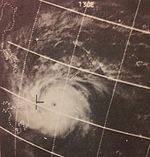
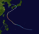
Nancy originated from the interaction between an active ITCZ and a cold front near the Caroline Islands and the equator in mid February. An increase in convection was shown by weather satellites on February 18 and by the following day a recon aircraft found a weak depression to the south of the Caroline Islands. The depression moved west, suppressed south by a high pressure ridge to the north, and gradually strengthened into a tropical storm and was given the name Nancy early on February 20. Nancy became a typhoon on the 22 about 100 miles northwest from Woleai. On February 23 Nancy passed to the north of Yap where strong gale winds occurred. Continuing to encounter more favorable conditions Nancy was able to achieve a peak intensity of 140 mph (220 km/h) and a pressure of 952 hPa (28.1 inHg) on February 24. This was the equivalent of a category four hurricane. It is rare to have a typhoon of this magnitude during the month of February, as noted by the JTWC, only Irma of the 1953 season reached the same intensity at the time. As Nancy approached the Philippine Islands the typhoon traversed to the western ambit of the ridge that had kept it to the south, allowing it to move farther in a north direction. During the 25 Nancy passed east off the coast of the easternmost islands of the Philippines. On the island of Catanduanes, the edge of the eye brushed the eastern coast. A U. S. Coast Guard loran station on Catanduanes recorded intense winds, at which point the equipment malfunctioned. The storm encountered a hostile environment to the northeast of Luzon and began to weaken. By February 26 Nancy had become a tropical storm and shortly afterward had transitioned into an extra tropical cyclone and moved off into open ocean. By the 28 what remained of Nancy was a frontal trough.
...
Wikipedia


