1972 Pacific typhoon season
| 1972 Pacific typhoon season |

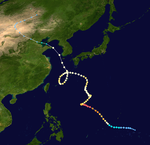
Season summary map
|
| Seasonal boundaries |
| First system formed |
January 5, 1972 |
| Last system dissipated |
December 19, 1972 |
| Strongest storm |
|
| Name |
Rita |
| • Maximum winds |
270 km/h (165 mph)
(1-minute sustained) |
| • Lowest pressure |
910 hPa (mbar) |
| Seasonal statistics |
| Total depressions |
38 |
| Total storms |
30 |
| Typhoons |
22 |
| Super typhoons |
2 |
| Total fatalities |
860 |
| Total damage |
$290 million (1972 USD) |
| Related articles |
|
|
Pacific typhoon seasons
1970, 1971, 1972, 1973, 1974
|
| Typhoon (JMA) |
| Category 4 typhoon (SSHWS) |
|
|
| Duration |
January 4 – January 11 |
| Peak intensity |
220 km/h (140 mph) (1-min) 940 hPa (mbar) |
| Tropical depression (JMA) |
| Tropical depression (SSHWS) |
|
|
| Duration |
April 2 – April 6 |
| Peak intensity |
55 km/h (35 mph) (1-min) 1004 hPa (mbar) |
| Typhoon (JMA) |
| Category 3 typhoon (SSHWS) |
|
|
| Duration |
May 27 – June 8 |
| Peak intensity |
195 km/h (120 mph) (1-min) 955 hPa (mbar) |
| Tropical Storm (JMA) |
| Tropical Storm (SSHWS) |
|
|
| Duration |
June 1 – June 4 |
| Peak intensity |
95 km/h (60 mph) (1-min) 990 hPa (mbar) |
| Tropical Storm (JMA) |
| Tropical Storm (SSHWS) |
|
|
| Duration |
June 1 – June 7 |
| Peak intensity |
85 km/h (50 mph) (1-min) 996 hPa (mbar) |
| Typhoon (JMA) |
| Category 1 typhoon (SSHWS) |
|
|
| Duration |
June 22 – June 27 |
| Peak intensity |
150 km/h (90 mph) (1-min) 980 hPa (mbar) |
| Tropical depression (PAGASA) |
|
|
| Duration |
June 28 – June 30 |
| Peak intensity |
55 km/h (35 mph) (10-min) |
| Typhoon (JMA) |
| Category 4 typhoon (SSHWS) |
|
|
| Duration |
July 4 – July 15 |
| Peak intensity |
220 km/h (140 mph) (1-min) 945 hPa (mbar) |
| Typhoon (JMA) |
| Category 5 super typhoon (SSHWS) |
|
|
| Duration |
July 5 – July 26 |
| Peak intensity |
270 km/h (165 mph) (1-min) 910 hPa (mbar) |
The 1972 Pacific typhoon season has no official bounds; it ran year-round in 1972, but most tropical cyclones tend to form in the northwestern Pacific Ocean between June and December. These dates conventionally delimit the period of each year when most tropical cyclones form in the northwestern Pacific Ocean.
The scope of this article is limited to the Pacific Ocean, north of the equator and west of the international date line. Storms that form east of the date line and north of the equator are called hurricanes; see 1972 Pacific hurricane season. Tropical Storms formed in the entire west Pacific basin were assigned a name by the Joint Typhoon Warning Center. Tropical depressions in this basin have the "W" suffix added to their number. Tropical depressions that enter or form in the Philippine area of responsibility are assigned a name by the Philippine Atmospheric, Geophysical and Astronomical Services Administration or PAGASA. This can often result in the same storm having two names.
A total of 36 tropical depressions formed this year in the Western Pacific, of which 30 became tropical storms. Twenty-two storms reached typhoon intensity, of which two reached super typhoon strength.
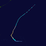
A tropical disturbance generated by an upper tropospheric low in the mid-Pacific trough moved westward through the Caroline Islands, slowly organizing into Tropical Depression 1W on January 5. The depression quickly strengthened, reaching tropical storm status later that day and becoming a typhoon on the 6th as it neared the Philippines. Kit rapidly intensified on the 6th and 7th to a 140 mph (230 km/h) typhoon, the strongest ever in January, but its inflow was cut off to the west, weakening the typhoon as it continued westward. Kit hit the eastern Philippines as a 100 mph (200 km/h) typhoon on January 7, and turned north through the archipelago in response to a break in the subtropical ridge. This brought Kit eastward then southward, where after completing its large loop it dissipated on January 15, just 170 nautical miles (310 km) from its starting location.
...
Wikipedia


