1957 Pacific typhoon season
| 1957 Pacific typhoon season |

Season summary map
|
| Seasonal boundaries |
| First system formed |
January 3, 1957 |
| Last system dissipated |
November 23, 1957 |
| Strongest storm |
|
| Name |
Lola |
| • Maximum winds |
295 km/h (185 mph) |
| • Lowest pressure |
900 hPa (mbar) |
| Seasonal statistics |
| Total depressions |
27 |
| Total storms |
22 |
| Typhoons |
18 |
| Super typhoons |
8 |
| Total fatalities |
644 |
| Total damage |
Unknown |
| Related articles |
|
|
Pacific typhoon seasons
1955, 1956, 1957, 1958, 1959
|
| Tropical storm (SSHWS) |
|
|
| Duration |
January 3 – January 7 |
| Peak intensity |
75 km/h (45 mph) (1-min) 995 hPa (mbar) |
| Category 4 super typhoon (SSHWS) |
|
|
| Duration |
January 21 – January 30 |
| Peak intensity |
250 km/h (155 mph) (1-min) 952 hPa (mbar) |
| Category 3 typhoon (SSHWS) |
|
|
| Duration |
April 11 – April 18 |
| Peak intensity |
185 km/h (115 mph) (1-min) 975 hPa (mbar) |
| Category 4 typhoon (SSHWS) |
|
|
| Duration |
May 2 – May 16 |
| Peak intensity |
220 km/h (140 mph) (1-min) 950 hPa (mbar) |
| Category 5 super typhoon (SSHWS) |
|
|
| Duration |
June 18 – June 26 |
| Peak intensity |
280 km/h (175 mph) (1-min) 900 hPa (mbar) |
| Category 2 typhoon (SSHWS) |
|
|
| Duration |
July 10 – July 18 |
| Peak intensity |
165 km/h (105 mph) (1-min) 985 hPa (mbar) |
| Category 4 super typhoon (SSHWS) |
|
|
| Duration |
August 11 – August 22 |
| Peak intensity |
250 km/h (155 mph) (1-min) 905 hPa (mbar) |
| Tropical storm (SSHWS) |
|
|
| Duration |
August 13 – August 20 |
| Peak intensity |
100 km/h (65 mph) (1-min) 984 hPa (mbar) |
| Tropical storm (JMA) |
|
|
| Duration |
August 22 – August 24 |
| Peak intensity |
75 km/h (45 mph) (10-min) 998 hPa (mbar) |
The 1957 Pacific typhoon season has no official bounds; it ran year-round in 1957, but most tropical cyclones tend to form in the northwestern Pacific Ocean between June and December. These dates conventionally delimit the period of each year when most tropical cyclones form in the northwestern Pacific Ocean.
The scope of this article is limited to the Pacific Ocean, north of the equator and west of the international date line. Storms that form east of the date line and north of the equator are called hurricanes; see 1957 Pacific hurricane season. Tropical Storms formed in the entire west Pacific basin were assigned a name by the Fleet Weather Center on Guam.
Twenty-two tropical storms developed in 1957 in the Northwestern Pacific. Tropical depressions were likely, but no records are known to exist that would mention any. Eighteen storms reached typhoon intensity, of which 8 reached super typhoon strength. An additional storm, Della, came across the Dateline from the Central Pacific, therefore it is not taken account in the total number of storms.
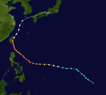
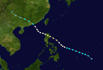
The first tropical cyclone of the 1957 season, classified as Tropical Storm 01W by the JTWC, was initially identified early on January 3 as a tropical depression over open waters east of the Philippines. Within several hours, the system intensified into a tropical storm as it tracked west-northwestward. Later that day, the storm attained its peak intensity with winds of 45 mph (75 km/h) and a barometric pressure of 995 mbar (29.38 inHg). Tropical Storm 01W maintained this intensity through January 5 before abruptly weakening to a tropical depression near the eastern Philippines. The system made landfall in eastern Leyte early on January 6 with winds of 35 mph (55 km/h) before dissipating the following day over Romblon.
About two weeks after Tropical Storm 01W dissipated over the Philippines, a new tropical depression formed to the southeast of Guam on January 21. Gradual intensification took place as the depression tracked westward. The JTWC began monitoring the system as Tropical Storm Rose the following day, with the first advisory on the storm placing maximum winds at 50 mph (85 km/h). Rose maintained this intensity for roughly 24 hours before undergoing a brief period of rapid intensification, attaining winds of 110 mph (175 km/h) early on January 23. For most of the day, the now Category 2 typhoon, strengthened at a more modest rate before undergoing a second brief period of rapid intensification. At the end of the second strengthening phase, Rose had attained its peak intensity just below Category 5 status, on the modern-day Saffir–Simpson Hurricane Scale, with winds of 155 mph (250 km/h), and a minimum pressure of 952 mbar (28.11 inHg). Upon attaining this intensity, Rose became the most intense January typhoon on record, surpassing that of Super Typhoon Karen in 1948.
...
Wikipedia


