1914 Atlantic hurricane season
| 1914 Atlantic hurricane season | |
|---|---|

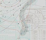
Season summary map
|
|
| Seasonal boundaries | |
| First system formed | September 15, 1914 |
| Last system dissipated | October 26, 1914 |
| Strongest storm | |
| Name | One (by default) |
| • Maximum winds | 70 mph (110 km/h) |
| • Lowest pressure | 995 mbar (hPa; 29.38 inHg) |
| Seasonal statistics | |
| Total depressions | 2 |
| Total storms | 1 (record low) |
| Total fatalities | None |
| Total damage | Unknown |
| Tropical storm (SSHWS) | |
| Duration | September 15 – September 19 |
|---|---|
| Peak intensity | 70 mph (110 km/h) (1-min) <995 mbar (hPa) |
The 1914 Atlantic hurricane season was the least active Atlantic hurricane season on record, with only one known tropical storm. Although hurricane season typically encompasses a much larger time-span, actual activity was confined to the middle of September. The only tropical cyclone of the year developed in the region of The Bahamas on September 15 and drifted northwestward, moving inland over Florida and Georgia. Thorough warnings before the storm prevented any major damage. The 1914 season is one of only two that did not produce any hurricanes (the other being the 1907 season). Due to the lack of modern technology, including satellite imagery, information is often sparse, and an additional tropical depression may have existed in late October.
With only one official tropical cyclone, the 1914 season was the least active Atlantic hurricane season on record. It is one of only two Atlantic seasons without a storm of hurricane intensity (winds of 75 mph (121 km/h) or stronger), the other being the 1907 season. The sole tropical storm's formation on September 14 represents the latest start to a hurricane season since officials records began in 1851.
Information on the 1914 season is chiefly based on data from the Atlantic hurricane database (HURDAT), which undertook a thorough reanalysis of hurricanes from 1911 through 1914 in 2005. Several changes, mostly of a minor nature, were made to the September tropical storm. Additionally, two other systems during the year were formally considered for inclusion into the hurricane database; one of them was deemed a potential tropical depression, but considered too weak to be classified a tropical storm. The other was assessed as a non-tropical system. The 2005 HURDAT reanalysis relied largely on historical weather maps and ship reports in place of modern technology, including satellite imagery.
The first and only tropical storm of the season originated in a westward-moving tropical wave denoted on weather maps from September 13. Decreases in air pressure occurred throughout the Bahamas, providing "strong indications of a disturbance". The system became a tropical depression at 00:00 UTC on September 15, approximately 200 mi (320 km) east of Miami, Florida. It strengthened into a tropical storm about 12 hours later, leading to the issuance of storm warnings from the east coast of Florida to as far north as Hatteras, North Carolina.
...
Wikipedia


