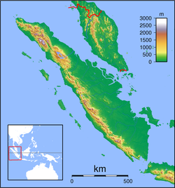
1861 Sumatra earthquake
| Date | February 16, 1861 |
|---|---|
| Magnitude | 8.5 Mw |
| Epicenter | 1°00′N 97°30′E / 1.0°N 97.5°ECoordinates: 1°00′N 97°30′E / 1.0°N 97.5°E |
| Areas affected | Sumatra, Dutch East Indies |
| Tsunami | yes |
| Casualties | several thousand |
The 1861 Sumatra earthquake occurred on February 16 and was the last in a sequences of earthquakes that ruptured adjacent parts of the Sumatran segment of the Sunda megathrust. It caused a devastating tsunami which led to several thousand fatalities. The earthquake was felt as far away as the Malay peninsula and the eastern part of Java. The rupture area for the 2005 Nias–Simeulue earthquake is similar to that estimated for the 1861 event.
The island of Sumatra lies on the convergent plate boundary between the Indo-Australian Plate and the Eurasian Plate. The convergence between these plates is highly oblique near Sumatra, with the displacement being accommodated by near pure dip-slip faulting along the subduction zone, known as the Sunda megathrust, and near pure strike-slip faulting along the Great Sumatran fault. The major slip events on the subduction zone interface are typically of megathrust type. Historically, great or giant megathrust earthquakes have been recorded in 1797, 1833, 1861, 2004, 2005 and 2007, most of them being associated with devastating tsunamis. Smaller (but still large) megathrust events have also occurred in the small gaps between the areas that slip during the larger events, in 1935, 1984, 2000 and 2002.
...
Wikipedia

