Čačak, Serbia
|
Čačak Град Чачак Gradac |
||||||||
|---|---|---|---|---|---|---|---|---|
| City | ||||||||
| City of Čačak | ||||||||
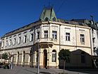
Clockwise, from top: City center promenade, National Museum, Church of Ascension of Jesus, Ovčar-Kablar Gorge, Bridges on West Morava, Hotel "Beograd"
|
||||||||
|
||||||||
| Etymology: Mud (sr. blato) | ||||||||
 Location of the city of Čačak within Serbia |
||||||||
| Coordinates: 43°53′N 20°21′E / 43.883°N 20.350°ECoordinates: 43°53′N 20°21′E / 43.883°N 20.350°E | ||||||||
| Country |
|
|||||||
| Region | Šumadija and Western Serbia | |||||||
| District | Moravica | |||||||
| Settlements | 58 | |||||||
| Government | ||||||||
| • Mayor | Milun Todorović (SNS) | |||||||
| Area | ||||||||
| Area rank | 43th | |||||||
| • Urban | 50.1 km2 (19.3 sq mi) | |||||||
| • Administrative | 636 km2 (246 sq mi) | |||||||
| Elevation | 242 m (794 ft) | |||||||
| Highest elevation (Ovčar) |
985 m (3,232 ft) | |||||||
| Lowest elevation | 204 m (669 ft) | |||||||
| Population (2011 census) | ||||||||
| • Rank | 12th | |||||||
| • Urban | 73,331 | |||||||
| • Urban density | 1,500/km2 (3,800/sq mi) | |||||||
| • Administrative | 115,337 | |||||||
| • Administrative density | 180/km2 (470/sq mi) | |||||||
| Time zone | CET (UTC+1) | |||||||
| • Summer (DST) | CEST (UTC+2) | |||||||
| Postal code | 32000 32101 32102 32103 32104 32105 |
|||||||
| Area code | +381(0)32 | |||||||
| ISO 3166 code | SRB | |||||||
| Car plates | ČA | |||||||
| Climate | Cfb | |||||||
| Website | www |
|||||||
Čačak (Serbian Cyrillic: Чачак, pronounced [t͡ʃǎːt͡ʃak]) is a city and the administrative center of the Moravica District in western Serbia. Čačak lies on the West Morava river, which is the second largest river in Serbia after the Danube (308 km), and between Šumadija and the Dinaric Alps, in the Čačak-Kraljevo valley. The lowest altitude is 204 m (confluence of Bresnička reka and Zapadna Morava) and the highest is 985 m (the highest peak of Ovčar mountain). According to the 2011 census results, the city urban area has 73,331 inhabitants, while the city administrative area has 115,337 inhabitants.
Čačak is the main crossroad and economic center in western Serbia, bordering with the several municipalities, Požega (Zlatibor District) to the west, Knić (Šumadija District) to the east and the city of Kraljevo (Raška District) to the southeast. It is also is the main administrative and cultural center of the Moravica District, which includes Gornji Milanovac to the north, Lučani to the southwest and Ivanjica to the south. It is located 144 km south of the capital city of Belgrade.
The city has a unique morphological area in its surroundings, the Ovčar-Kablar Gorge, where 300 monasteries have been built since the 14th century, but only 12 remain today. This area is also called "Serbian Mount Athos." Čačak got its current name in 1408; before that it was called Gradac. One of Gradac's leaders was Stracimir Zavidović, brother of Stefan Nemanja, an important Serbian ruler. He built the church of 'Our Lady' (Church of Jesus Ascension), which still stands in the center of Čačak. The church underwent reconstruction from 2010 to 2011, following an earthquake which damaged its facade.
...
Wikipedia


