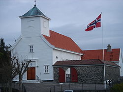
Øygarden
| Øygarden kommune | |||
|---|---|---|---|
| Municipality | |||
 |
|||
|
|||
 Øygarden within Hordaland |
|||
| Coordinates: 60°36′39″N 04°49′29″E / 60.61083°N 4.82472°ECoordinates: 60°36′39″N 04°49′29″E / 60.61083°N 4.82472°E | |||
| Country | Norway | ||
| County | Hordaland | ||
| District | Midhordland | ||
| Administrative centre | Rong | ||
| Government | |||
| • Mayor (2011) | Otto Harkestad (Ap) | ||
| Area | |||
| • Total | 66.74 km2 (25.77 sq mi) | ||
| • Land | 64.43 km2 (24.88 sq mi) | ||
| • Water | 2.31 km2 (0.89 sq mi) | ||
| Area rank | 407 in Norway | ||
| Population (2011) | |||
| • Total | 4,704 | ||
| • Rank | 213 in Norway | ||
| • Density | 73.0/km2 (189/sq mi) | ||
| • Change (10 years) | 19.7 % | ||
| Demonym(s) | Øygarding | ||
| Time zone | CET (UTC+1) | ||
| • Summer (DST) | CEST (UTC+2) | ||
| ISO 3166 code | NO-1259 | ||
| Official language form | Nynorsk | ||
| Website | www |
||
|
|
|||
Øygarden is a municipality in Hordaland county, Norway. It is an island municipality located in the traditional district of Midhordland. Since 2009, the administrative centre of Øygarden has been the village of Rong (before 2009, the village of Tjeldstø was the administrative centre). Other villages in the municipality include Alveim, Blomvåg, and Vikavågen.
The municipality consists of a chain of islands north of the municipality Fjell and northwest of the city of Bergen. Øygarden is connected to the mainland by a series of bridges and a single road running across the islands.
The municipality of Øygarden was established on 1 January 1964. It was created by a merger that was set in motion by the Schei Committee. The old municipality of Hjelme (population: 956) and all of the municipality of Herdla located west of the Hjeltefjorden except for the islands of Turøy and Misje (population: 2131).
The name is the finite form of øygard which means "row (fence) of islands". The first element is øy means "island" and the last element is gard which means "farm".
The coat-of-arms is from modern times; they were granted in 1966, shortly after the establishment of the municipality. The arms show a black and gray reference seacairn sitting on an islet on a blue background. The municipality consists of a number of islands and is dependent on the sea for its development. Hence the importance of sea cairns, buoys and lighthouses for safety in the municipality.
...
Wikipedia


