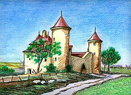
Étrembières
| Étrembières | ||
|---|---|---|

|
||
|
||
| Coordinates: 46°10′42″N 6°13′36″E / 46.1783°N 6.2267°ECoordinates: 46°10′42″N 6°13′36″E / 46.1783°N 6.2267°E | ||
| Country | France | |
| Region | Auvergne-Rhône-Alpes | |
| Department | Haute-Savoie | |
| Arrondissement | Saint-Julien-en-Genevois | |
| Canton | Annemasse-Sud | |
| Intercommunality | Annemasse – Les Voirons | |
| Government | ||
| • Mayor (2014–2020) | Alain Bosson | |
| Area1 | 5.43 km2 (2.10 sq mi) | |
| Population (2014)2 | 2,304 | |
| • Density | 420/km2 (1,100/sq mi) | |
| Time zone | CET (UTC+1) | |
| • Summer (DST) | CEST (UTC+2) | |
| INSEE/Postal code | 74118 / 74100 | |
| Elevation | 393–860 m (1,289–2,822 ft) | |
|
1 French Land Register data, which excludes lakes, ponds, glaciers > 1 km² (0.386 sq mi or 247 acres) and river estuaries. 2Population without double counting: residents of multiple communes (e.g., students and military personnel) only counted once. |
||
1 French Land Register data, which excludes lakes, ponds, glaciers > 1 km² (0.386 sq mi or 247 acres) and river estuaries.
Étrembières is a commune in the Haute-Savoie department in the Auvergne-Rhône-Alpes region in south-eastern France.
Étrembières territory is a land extension of 8 kilometres (5 mi)long (5 miles), located at foot of mount Salève, and at banks of Arve River, between Annemasse, Gaillard and Bossey communes. The commune has a population of 1600 inhabitants (2006). The Sàleve mount surges at a steep cliff at west producing an inclination to the Arve's river valley. Sàleve mount is composed of two parts. The great Salève (1318 m.) and the small Salève (902 m.) apart from one of the other by the collar of Monnetier.
The region had a prehistoric occupation revealed by excavations, where upper Magdalenian period tools were found, such as stone tools, decorated with otters and Alpine ibex figures.
The Roman road Genava crossed the Arve river to Etrembières, at the closes area between the banks of the river. A wooden bridge was built to improve the transportation between the two sides, despite there is no mention of this bridge in the ancient period, it is mentioned in a 1304 agreement between the Count of Genevois and sire of Faucigny.
From the 11th to the 15th centuries, Étrembières, and principally its bridge, were a strategic point of control of geneve count, during this time the social life was affected by the frequent battles between with the lords and the vassals of Gex, Mornex and Faucigny.
After the Calvinist reform in Genova, an important part of catholic population exited in the small communes of the area. Étrembières is considered a catholic village. After Charles-Emmanuel, the duke of Savoie built the château des Terreaux, in 1602 started a military action to Genève, to recover part of the provinces caused by the signing of Lyon Treaty, in 1601, and to reestablish the Catholicism is the city. The expedition turned into a military disaster that ended with the signing of Saint-Julien treaty in 1603. Genève commemorated the victory with a celebration known as L'Escalade.
...
Wikipedia


