Portland metropolitan area
| Portland metropolitan area | |
|---|---|
| Portland metropolitan area | |
 |
|
| Country | United States |
| State(s) |
Oregon Washington |
| Largest city | Portland, Oregon (632,309) |
| Other cities |
Vancouver (172,860) Gresham (110,553) Hillsboro (102,347) Beaverton (96,577) |
| Area | |
| • Total | 6,684 sq mi (17,310 km2) |
| Highest elevation | N/A ft (N/A m) |
| Lowest elevation | N/A ft (N/A m) |
| Population | |
| • Total | 2,389,228 |
| • Rank | 23rd in the U.S. |
| • Density | 357/sq mi (129/km2) |
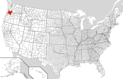
The Portland metropolitan area or Greater Portland is a metropolitan area in the U.S. states of Oregon and Washington centered on the principal city of Portland, Oregon. The U.S. Office of Management and Budget identifies it as the Portland–Vancouver–Hillsboro, OR–WA Metropolitan Statistical Area, a metropolitan statistical area used by the United States Census Bureau and other entities. The OMB defines the area as comprising Clackamas, Columbia, Multnomah, Washington, and Yamhill Counties in Oregon, and Clark and Skamania Counties in Washington. The area's population is estimated at 2,348,247 in 2014.
The Oregon portion of the metropolitan area is the state's largest urban center, while the Washington portion of the metropolitan area is the state's third largest urban center after Seattle (the Seattle Urban Area includes Tacoma and Everett) and Spokane. Portions of this are under the jurisdiction of Metro, a directly elected regional government which, among other things, is responsible for land-use planning in the region.
As of the 2010 census, there were 2,226,009 people, 867,794 households, and 551,008 families residing within the MSA. The racial makeup of the MSA were as followed:
...
Wikipedia
