Glasgow, Kentucky
| Glasgow, Kentucky | |
|---|---|
| City | |

South Green Street in Glasgow, KY
|
|
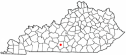
 Location of Glasgow, Kentucky |
|
| Coordinates: 37°0′1″N 85°55′13″W / 37.00028°N 85.92028°WCoordinates: 37°0′1″N 85°55′13″W / 37.00028°N 85.92028°W | |
| Country | United States |
| State | Kentucky |
| County | Barren |
| Established | 1799 |
| Named for | the Scottish hometown of the family of William Logan |
| Government | |
| • Mayor | Dick Doty |
| Area | |
| • Total | 15.5 sq mi (40.2 km2) |
| • Land | 15.4 sq mi (40.0 km2) |
| • Water | 0.08 sq mi (0.2 km2) |
| Elevation | 755 ft (230 m) |
| Population (2010) | |
| • Total | 14,028 |
| • Density | 908/sq mi (350.6/km2) |
| Time zone | Central (CST) (UTC-6) |
| • Summer (DST) | CDT (UTC-5) |
| ZIP codes | 42141, 42142, 42156 |
| Area code(s) | 270 & 364 |
| FIPS code | 21-31114 |
| GNIS feature ID | 0492876 |
| Website | www |
Glasgow is a home rule-class city in Barren County, Kentucky, in the United States. It is the seat of its county. The population was 14,028 at the 2010 U.S. census. The city is well known for its annual Scottish Highland Games. In 2007, Barren County was named the number one rural place to live by The Progressive Farmer magazine. Glasgow is the principal city of the Glasgow micropolitan area, which comprises Barren and Metcalfe counties.
Glasgow is located in central Barren County at 37°0′1″N 85°55′13″W / 37.00028°N 85.92028°W (37.000375, -85.920229).U.S. Route 31E and U.S. Route 68 intersect at the center of the city, and the Louie B. Nunn Cumberland Parkway passes south of downtown, with access from three exits. Bowling Green is 32 miles (51 km) to the west, Mammoth Cave National Park is 21 miles (34 km) to the northwest, Elizabethtown is 55 miles (89 km) to the north, Columbia is 37 miles (60 km) to the east, and Scottsville is 24 miles (39 km) to the southwest.
...
Wikipedia
