Zuni, New Mexico
| Zuni Pueblo, New Mexico | |
|---|---|
| CDP | |

Zuni Pueblo, 1850 illustration
|
|
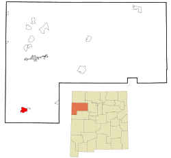
 Location of Zuni Pueblo, New Mexico |
|
| Location in the United States | |
| Coordinates: 35°4′10″N 108°50′48″W / 35.06944°N 108.84667°WCoordinates: 35°4′10″N 108°50′48″W / 35.06944°N 108.84667°W | |
| Country | United States |
| State | New Mexico |
| County | McKinley |
| Area | |
| • Total | 8.8 sq mi (22.9 km2) |
| • Land | 8.8 sq mi (22.9 km2) |
| • Water | 0.0 sq mi (0.0 km2) |
| Elevation | 6,293 ft (1,918 m) |
| Population (2000) | |
| • Total | 6,367 |
| • Density | 720.0/sq mi (278.0/km2) |
| Time zone | Mountain (MST) (UTC-7) |
| • Summer (DST) | MDT (UTC-6) |
| ZIP code | 87327 |
| Area code(s) | 505 |
| FIPS code | 35-86595 |
| GNIS feature ID | 1867391 |
Zuni Pueblo (Zuni: Shiwinna, also Zuñi Pueblo and Pueblo de Zuñi) is a census-designated place (CDP) in McKinley County, New Mexico, United States. The population was 6,302 as of the 2010 Census. It is inhabited largely by members of the Zuni people.
The first contact with Europeans occurred in 1539 in the ancient village of Hawikku when Esteban, an Arab/Berber of Moroccan origin, entered Zuni territory seeking the fabled "Seven Cities of Cibola."
It is on the Trails of the Ancients Byway, one of the designated New Mexico Scenic Byways.
Zuni Pueblo is located at 35°4′10″N 108°50′48″W / 35.06944°N 108.84667°W (35.069327, -108.846716).
According to the United States Census Bureau, the CDP has a total area of 8.8 square miles (23 km2), all land.
As of the census of 2000, there were 6,367 people, 1,488 households, and 1,334 families residing in the CDP. The population density was 720.0 people per square mile (278.1/km²). There were 1,622 housing units at an average density of 183.4 per square mile (70.8/km²). The racial makeup of the CDP was 97.03% Native American, 2.12% White, 2.01% Hispanic or Latino, 0.03% African American, 0.03% Asian, 0.30% from other races, and 0.49% from two or more races.
...
Wikipedia

