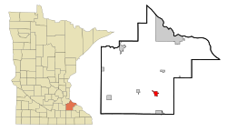
Zumbrota, Minnesota
| Zumbrota, Minnesota | |
|---|---|
| City | |
 |
|
| Motto: "Bridging the Past and the Future" | |
 Location of Zumbrota, Minnesota |
|
| Coordinates: 44°17′34″N 92°40′18″W / 44.29278°N 92.67167°WCoordinates: 44°17′34″N 92°40′18″W / 44.29278°N 92.67167°W | |
| Country | United States |
| State | Minnesota |
| County | Goodhue |
| Area | |
| • Total | 2.68 sq mi (6.94 km2) |
| • Land | 2.67 sq mi (6.92 km2) |
| • Water | 0.01 sq mi (0.03 km2) |
| Elevation | 991 ft (302 m) |
| Population (2010) | |
| • Total | 3,341 |
| • Estimate (2012) | 3,293 |
| • Density | 1,218.0/sq mi (470.3/km2) |
| Time zone | Central (CST) (UTC-6) |
| • Summer (DST) | CDT (UTC-5) |
| ZIP code | 55992 |
| Area code(s) | 507 |
| FIPS code | 27-72328 |
| GNIS feature ID | 0654511 |
| Website | ci.zumbrota.mn.us |
Zumbrota is a city in Goodhue County, Minnesota, United States, along the North Fork of the Zumbro River. The population was 3,252 at the 2010 census. It promotes itself as "the only Zumbrota in the world."
Zumbrota was claimed as a town in 1856 by Joseph Bailey and D.B. Goddard. The name Zumbrota appears to have resulted from a corruption of the French name for the local Zumbro River, Rivière des Embarras (Obstruction River), coupled with the Dakota toŋ (village).
Zumbrota is home to the Zumbrota Covered Bridge, the last functioning covered bridge in the state of Minnesota. It was originally installed in 1869, one year before the arrival of railroads to the area. The bridge is listed on the National Register of Historic Places.
The Zumbrota Public Library was the first tax-supported library in Minnesota.
The city of Zumbrota celebrated its sesquicentennial in 2006.
According to the United States Census Bureau, the city has a total area of 2.68 square miles (6.94 km2), of which 2.67 square miles (6.92 km2) is land and 0.01 square miles (0.03 km2) is water.
U.S. Route 52 and Minnesota State Highways 58 and 60 are the three main highways in the city.
As of the census of 2010, there were 3,252 people, 1,349 households, and 882 families residing in the city. The population density was 1,218.0 inhabitants per square mile (470.3/km2). There were 1,437 housing units at an average density of 538.2 per square mile (207.8/km2). The racial makeup of the city was 95.8% White, 0.7% African American, 0.5% Native American, 0.7% Asian, 0.6% from other races, and 1.7% from two or more races. Hispanic or Latino of any race were 1.6% of the population.
...
Wikipedia
